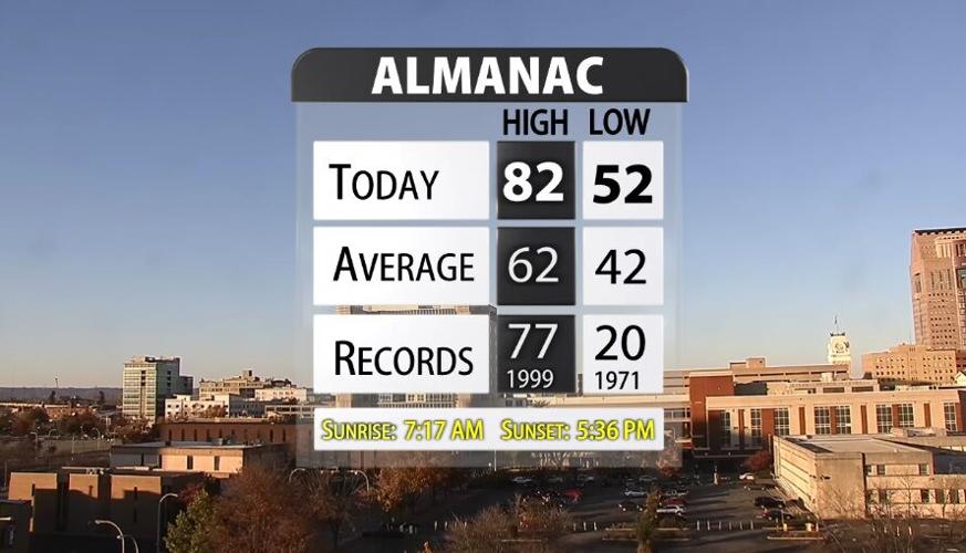
Sunday we broke the daily high temperature record, but this is just the beginning of record-breaking heat! The hottest we have ever been before on November 8 in Louisville was 77º. That record was set back in 1999, but we beat it today. The high temperature in Louisville was 82º, and most of you made it into the low 80s this afternoon.

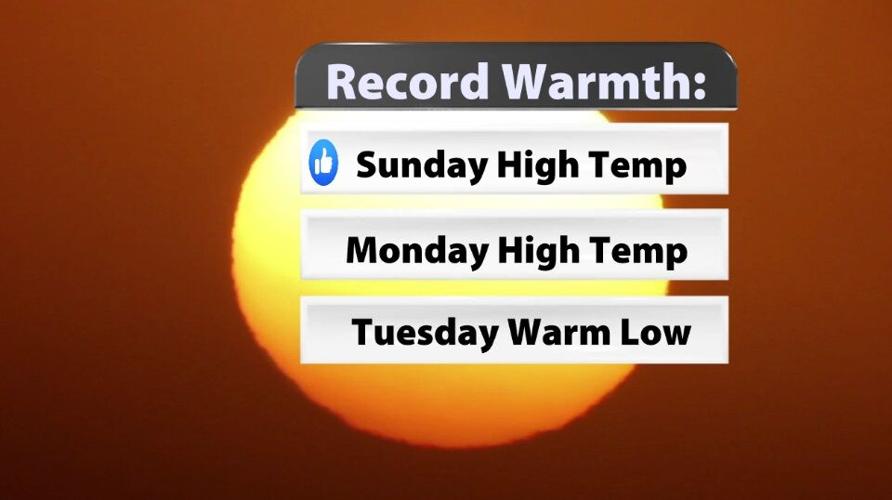
This is not the only temperature record I expect to tie or break in the coming days. Monday's high temperature record is also in jeopardy as is the warm low temperature Tuesday morning. That's a slightly harder record to explain, but the warmest the low temperature has ever been on November 10 is 60º. That record was set back in 1985, and I (Hannah) am forecasting a low of 60º Tuesday morning. That's not quite as sure a bet as the other two records, but we will definitely come close!

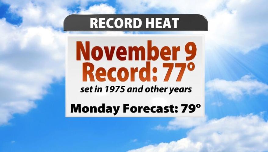
The hottest we have ever been before on November 9 in Louisville is also 77º. That record was first set back in 1975 and has been tied since then but never broken. We expect the high temperature to be in the upper 70s Monday, so we will have to watch the mercury rise through the afternoon.

Yes, this air is unseasonably warm, but now we've entered a new category of November heat.
Where is all this record-breaking warmth coming from?
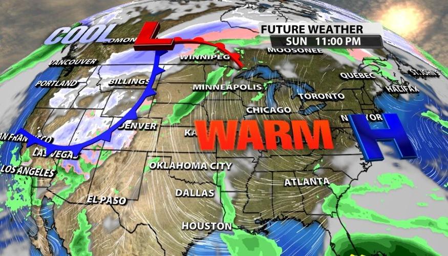
The big blue H is a high pressure center positioned just east of us. The air around one of these high pressure centers moves clockwise which is why our air has been coming out of the south or southeast for the last few days. Since that high pressure center hasn't moved very much in the last few days, the air flow is funneling warm air straight into our region for several days straight.

How long will this heat last?
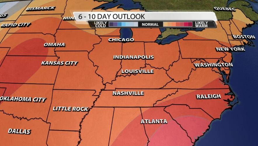
The record-breaking heat will be gone in a few days, but there are some signals in the longer-range that we may be holding on to "warmer than normal" air for a bit longer. First, some context. Average high temperatures this time of year are in the low 60s and lows in the low 40s. Anything above that is considered "warmer than normal" on this map below. We are not forecasting a week and a half of 80-degree days, but it looks like we will be near or slightly above normal temperatures for the next week or two.


