


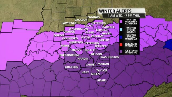
Winter Weather Advisories and Ice Storm Warnings go into effect at 1 a.m. Wednesday for all of the counties below. It doesn't expire until 7 p.m. Thursday, which is a full 42 hours later! That's why I'm saying this is a marathon, not a sprint. Before we get into the hour-by-hour outlook, I want you to know this isn't going to be a big snow maker. Ice appears to be the bigger issue, especially in central/southern Kentucky.
A warning shot of light freezing rain or drizzle moves in tonight so don't be surprised to step outside Wednesday morning to a thin glaze of ice.
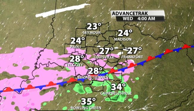
That light wintry mix hangs around during the morning hours meaning slick spots are certainly possible on untreated and elevated roads.

If you are worried about the drive home on Wednesday, I would highly recommend getting home as soon as possible. As the afternoon wears on, precipitation becomes more intense. After sunset in when conditions really deteriorate because we lose the "heating" of the day and temps fall fast.
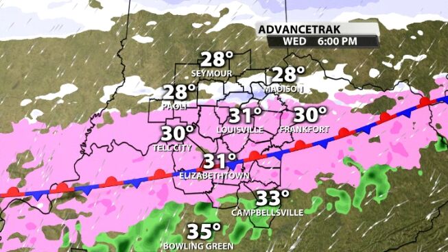
Check out the image of future radar and notice those brighter shades of pink. That is moderate freezing rain coming down at 11 p.m. for parts of our area. This is a dangerous situation!
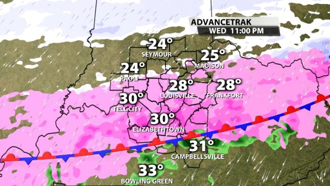
Snow, sleet and freezing rain continue overnight. Louisville should see that transition from freezing rain, to sleet, then finally to snow around 2 to 4 a.m. Listen, if you don't have to be out on the roads Wednesday night, I would just stay put.
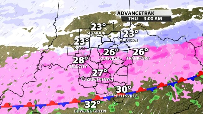
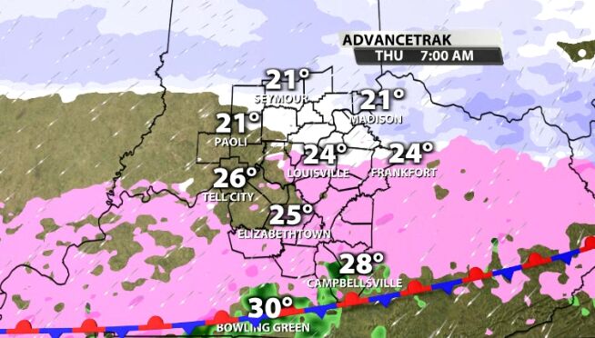
The Thursday morning commute will be the most problematic. In Louisville, there could be a layer of ice hidden under a couple inches of snow/sleet. Please use extreme caution because as you know, ice is the the worst!
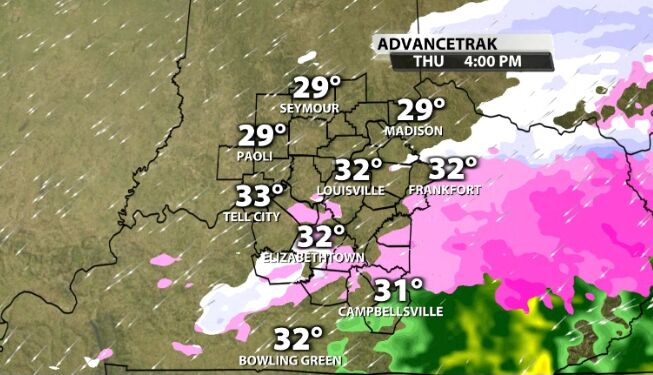
Another hit of wintry weather arrives Thursday, however, Kentucky get's hit the hardest while not much is happening in Southern Indiana.
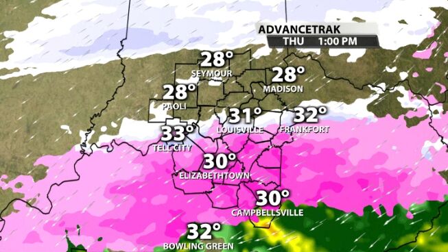
Thursday evening is when things begin to dry out. That doesn't mean we won't see lingering issues as winds pick up Friday potentially stressing out the trees and power lines even more.
Travel and power impacts are likely late Wednesday through Thursday for sections of Kentuckiana! Make sure you watch us on TV at 10 & 11 for the latest ice and snow totals. The WDRB Weather Team is the source and we will have you covered each step of the way.


