


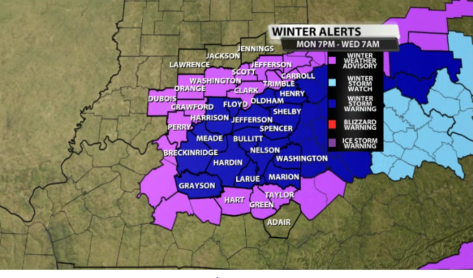
Ahead of the approaching snowfall, the NWS has issued a Winter Storm Warning for the highlighted counties from 7PM this evening until 7AM Wednesday.
Here's more from the NWS on the warning:
We will have an update on totals and timing from the WDRB Weather team as we progress into the afternoon in another blog on our website and on air!
* WHAT...Heavy mixed precipitation expected. Total snow
  accumulations between 3 and 5 inches and ice accumulations around
  a light glaze. Locally higher snow totals are possible with heavy
  banded snow.

* WHERE...Portions of south central Indiana and east central, north
  central, and south central Kentucky.

* WHEN...From 7 PM EST /6 PM CST/ this evening to 7 AM EST /6 AM
  CST/ Wednesday.

* IMPACTS...Plan on slippery road conditions. The hazardous
  conditions could impact the Tuesday morning and evening commutes.


