
The Beginning Of The March 2, 2012 Tornado Outbreak
Friday, March 2, 2012, is a day that we will never forget. We compiled an archive of radar images to show what StormView 3D displayed as the tornadoes moved through southern Indiana / northern Kentucky. This will be an opportunity for you to see inside a storm from the perspective of a meteorologist, plus what we saw from spotters on the ground. Check out this in-depth analysis...
The devastating day began as one supercell thunderstorm developed in southern Illinois, then came into Indiana. Notice there appear to be small showers ahead of this supercell near Evansville. This was the beginning of the devastating supercell thunderstorm.
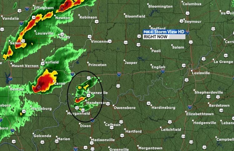
As these showers began to move to the east, they intensified into three supercells. This became incredibly important. At this point normally the southern storm takes over, and we would have to watch this closely.
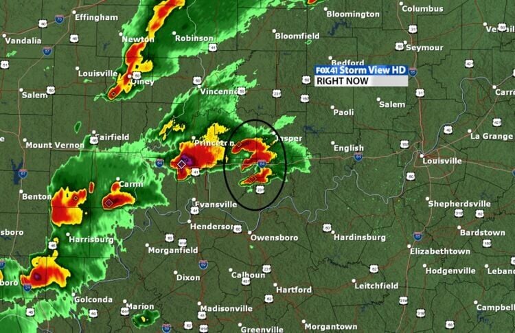
Within about 10 minutes, the southern storm dominated and it was clear this would be an incredibly dangerous storm.
It should be noted that if these showers developed 3-5 minutes earlier and further south, then that could have altered the trajectory of these storms and likely would have moved them into Louisville. Only minutes made that difference in the ultimate storm's track.
The night before this event, Marc wrote in his weather blog:
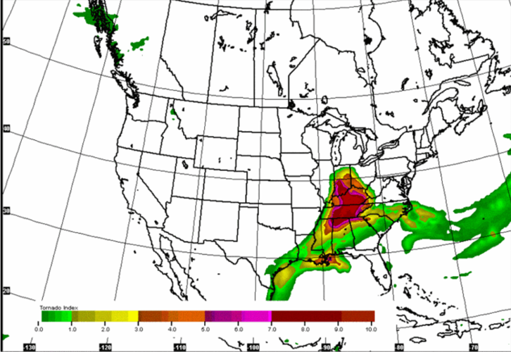
The NAM has a parameter called the "significant tornado probability" index. It can show you where the best chance of tornadoes exist. Notice is pegs values off the chart for us tomorrow (March 2)!!! Literally, these values are as high as they get!
NAM Significant Tornado Probability at 4 PM Friday (March 2)

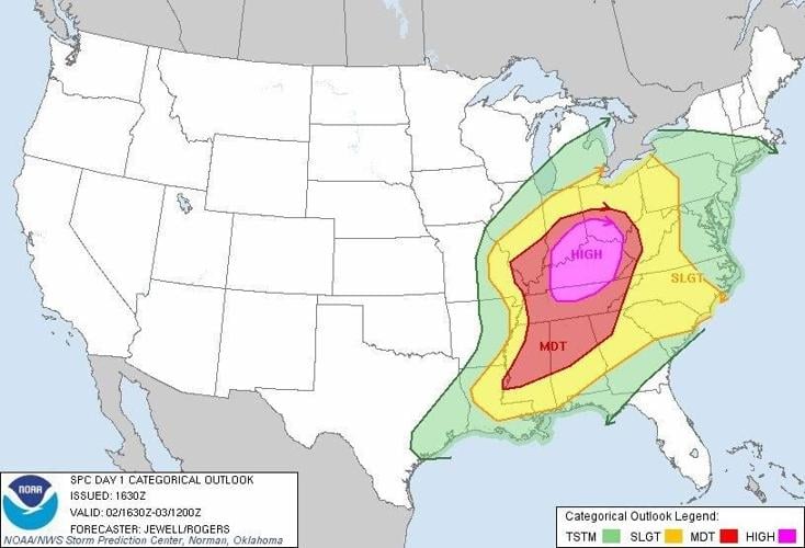
The SPC had a rare "High" (level 5/5) risk out for our area that day as well...

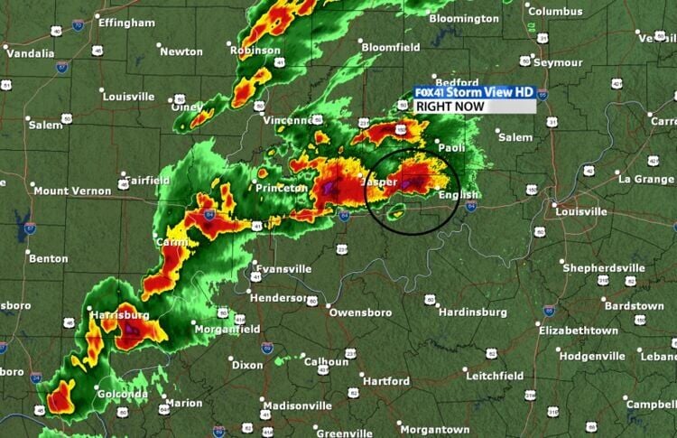
The Storms Intensify Between Milton, IN & Hardinsburg, IN
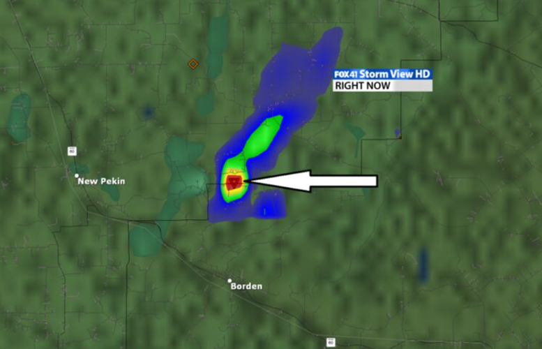
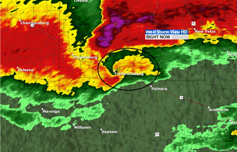
These "twin" supercells were now moving through southern Indiana around 1:45 pm on Friday evening. Both had "hooks" indicating significant rotation on them. Remember a hook forms because the rotation on the southwest side of the storm is so intense that it pulls the rain from the storm around the rotation center.
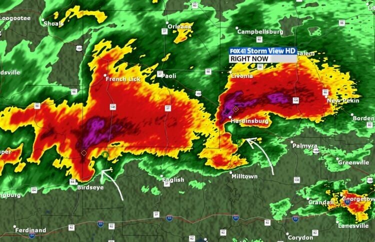
As the storms near Palmyra, the rotation started to increase. Remember we look for greens next to red to indicate where the rotation is located. There is clearly a very strong rotation showing up on this storm.

The eastern most storm was the storm that did the most damage, so let's focus a little more on that storm.
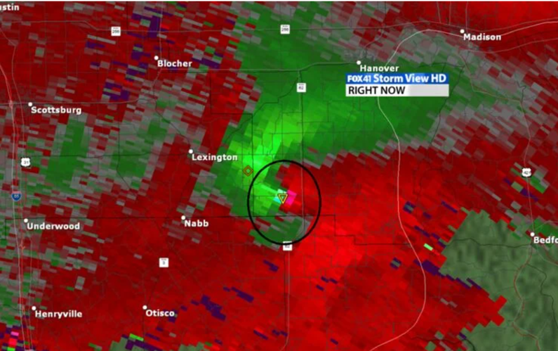
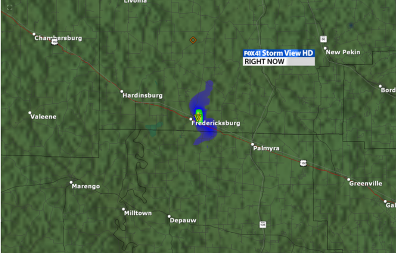
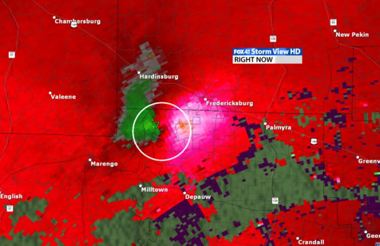
The Palmyra Tornado
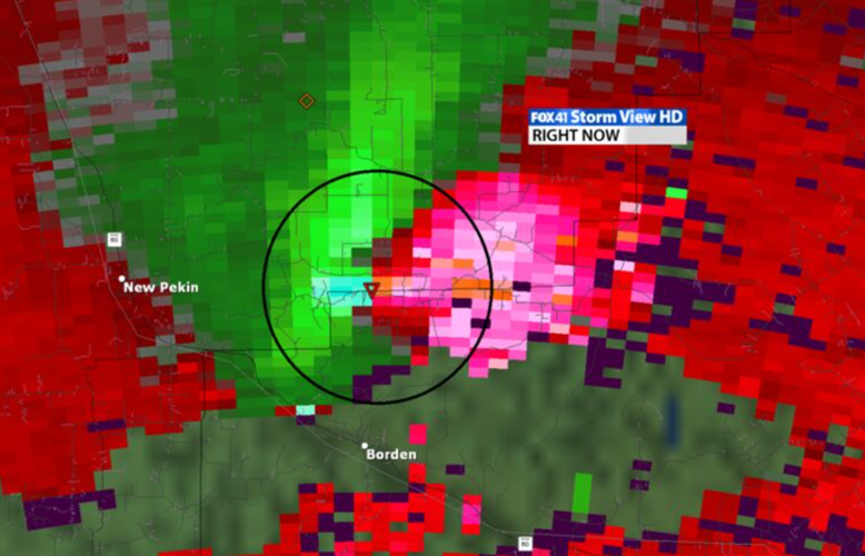
As the storm moved into the Palmyra area, we felt strongly that it did have a tornado on it from the radar display. At this point, you can see a very distinct hook on the storm and a bright circle on the end of the hook. This could be and in my opinion was debris being picked up and lofted by the destructive tornado.

The velocity data at this point showed greens and reds VERY close to each other indicating powerful rotation and what I felt was a definite tornado on the ground. That rotation is 149 MPH rotation showing up on StormView 3D.

StormView 3D can also tell the user if it thinks a tornado is on the ground. Green's are a good indicator of a tornado, yellows are only on rare strong tornadoes, and reds almost never show up because they are indicative of strong to violent tornadoes.

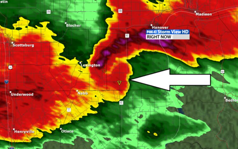
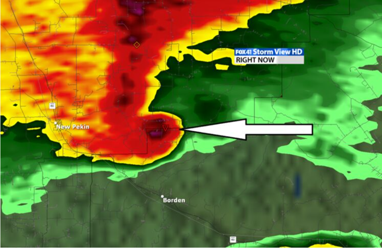
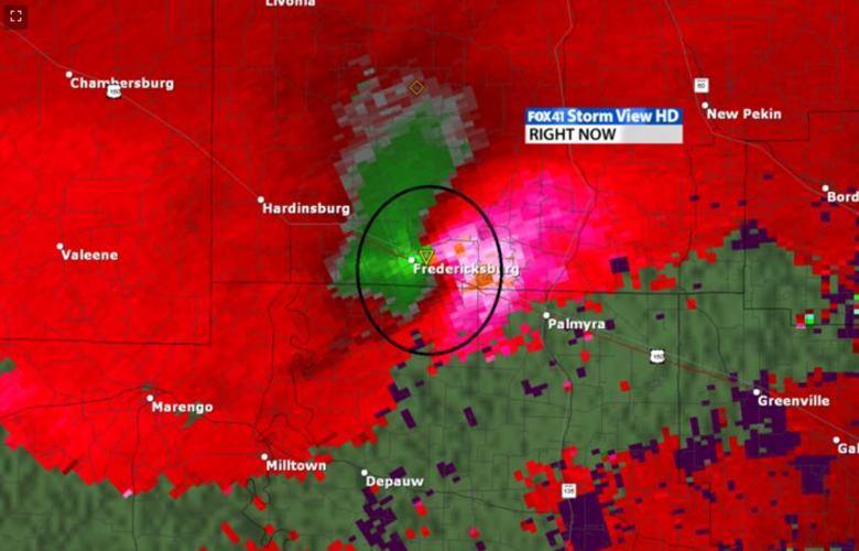
As the storm left Palmyra, a debris ball showed up. What is a debris ball? A debris ball is an area of bright reflectivity (purples and yellows and blacks) indicating a tornado has caused extensive damage and the tornado is now lofting that damage up into the air.

StormView 3D indicates that debris was lofted up 5,000 to 8,000 feet.
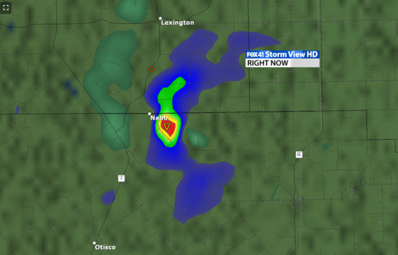
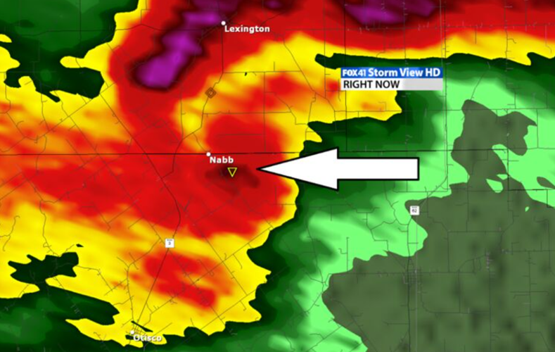
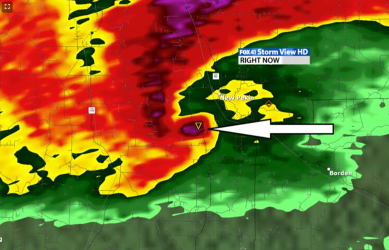
The Pekin/Borden Tornado
The storm continued to move toward the east, and the debris ball stayed just as intense indicating severe damage was being caused by this tornado.

The rotation on this storm was simply off the charts. The greens even started to look blue indicating extreme wind velocity in this tornado. StormView 3D shows an area of rotation was spinning at 185 mph now.

Now StormView 3D didn't just indicate a tornado, it indicated a strong to violent tornado.


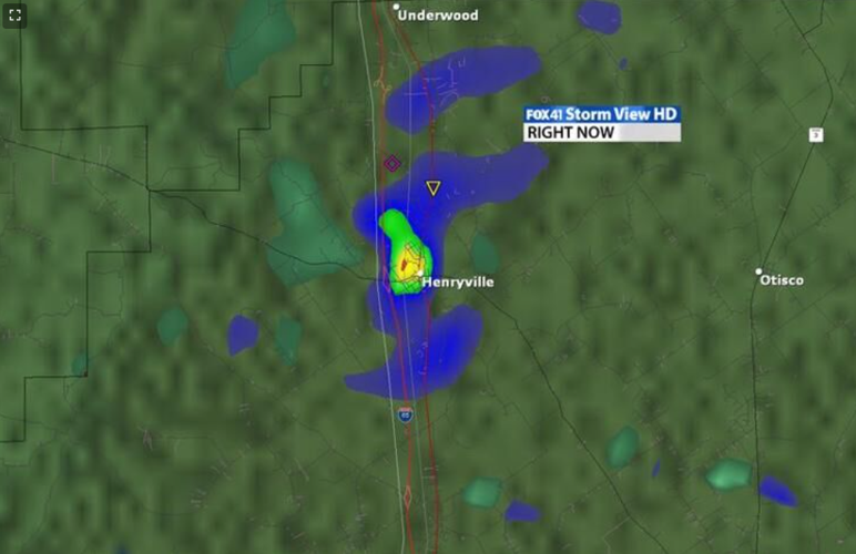
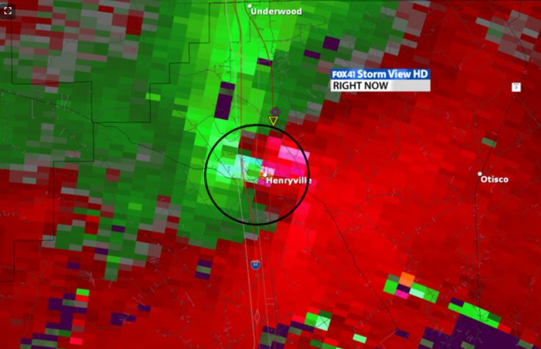
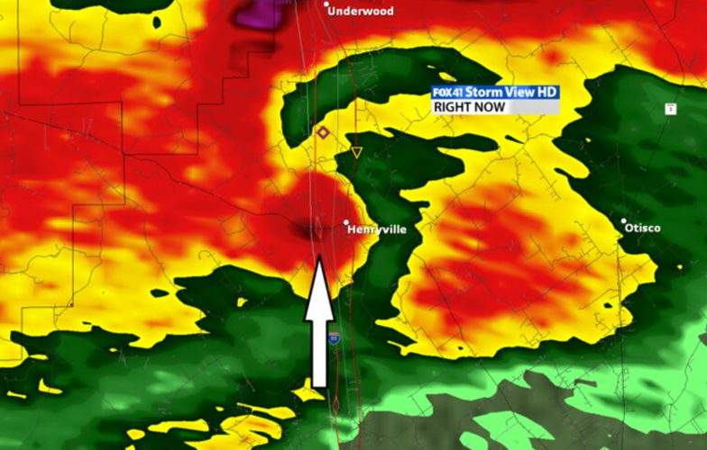
The Tornado Moves Into Henryville, IN
Once the Palmyra tornado formed, we knew it was a long track tornado event that was occurring and tried to warn Henryville for about 30 minutes. The storm had a clear debris ball as it moved into Henryville, IN.


The rotation came down just a touch on StormView 3D as it entered Henryville, IN, but it was still a force. StormView 3D showed the storm was spinning around 137 mph.

StormView 3D still showed a definite sign of a tornado right over Henryville.

The tornado "tube" on StormView 3D was scary at this point. You can see the clear tube of the tornado touching the ground and extending 25,000 feet up.
Tornado Moves Into Marysville, IN
As we know, the destruction was incredible on this storm. The debris ball was a little smaller here, but still very visible. I (Marc) suspect the debris from Henryville may have fallen out of the storm a little at this point.

The rotation was picking up again as it moved through Marysville, IN. Rotation was about 164 mph on StormView 3D at this point. StormView 3D continued to show reds at this point, indicating a high probability of a tornado and likely violent.

The tornado tube was remarkable at this point. It extended 30,000 feet into the atmosphere and was clearly connected to the ground.
Tornado Moves Through Chelsea, IN
The tornado continued to move east and now it took aim on Chelsea, IN. StormView 3D continued to show a debris ball on the storm, but it wasn't as sharp as when it went through the heavily populated Henryville, IN.

The rotation remained extremely intense. StormView 3D indicated 137 mph of rotation as the storm hit Chelsea, IN.

Once again, the tornado tube was incredible and may even indicate there were two on the ground at this point. Some of the data suggest this possibility at a few times during the storm.
Summary
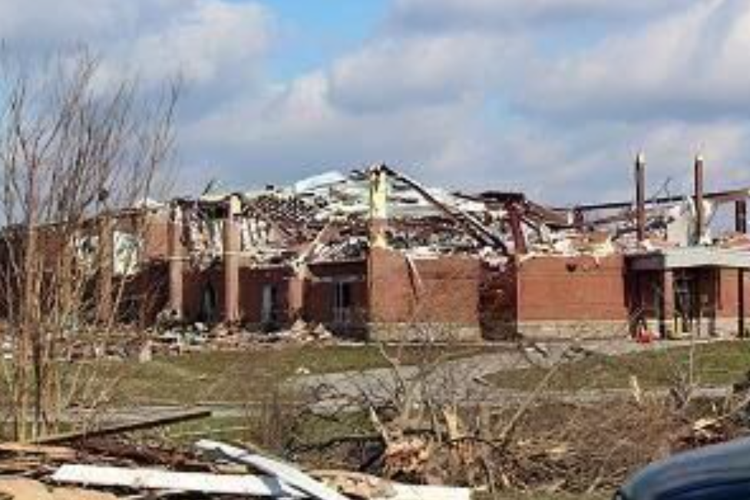
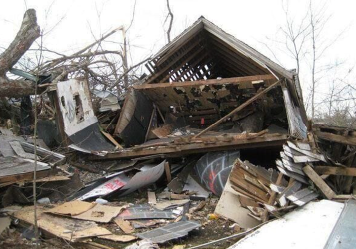
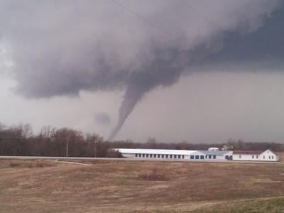
There were two supercell storms that moved across southern Indiana on March 2, 2012. These were "cyclic" supercells that appear to have produced multiple tornadoes. The largest tornado started near Fredricksburg, IN and continued on the ground for 49 miles ending 3 miles NW of Bedford, KY. This tornado was ranked as an EF-4 with 175 mph winds at its strongest. The tornado at its largest was around 1/2 miles wide. EF-4 tornadoes comprise only 2% of all the tornadoes to hit the U.S., so this was a very rare event. You can cycle through the images below to see some of that destruction.


