

Temperatures for much of this week are above normal before our next storm system arrives on Thursday & Friday. However, when looking at long-range data, you can see hints of something brewing up north. By up north, we mean way up north near the poles and laterally north in the stratosphere!
Ever heard of a stratospheric warming event? We had one in our area in early December if you recall, which brought one of the coldest temperatures of 2025 at 5 degrees. In case you don't know what a stratospheric warming event is, here's an explanation. If you already know, skip down to the "January Stratospheric Warming" section.
What is a stratospheric warming event?
The stratosphere is the layer of the atmosphere extending from ~6 miles to ~31 miles above the surface. The stratospheric polar vortex (we bet you've heard of the polar vortex!) resides in this area, and can significantly influence weather in the mid-latitudes.
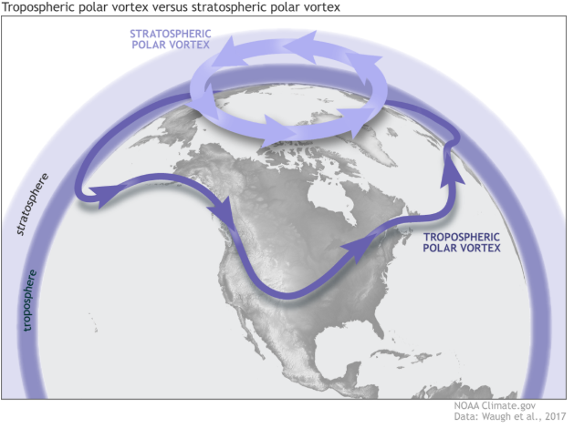
The stratospheric polar vortex and tropospheric vortex are two different things. The tropospheric polar vortex is a normal atmospheric feature that affects our weather every winter. For the remainder of this post, we’ll be talking about the stratospheric one.
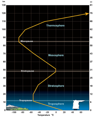
Courtesy: Climate.gov
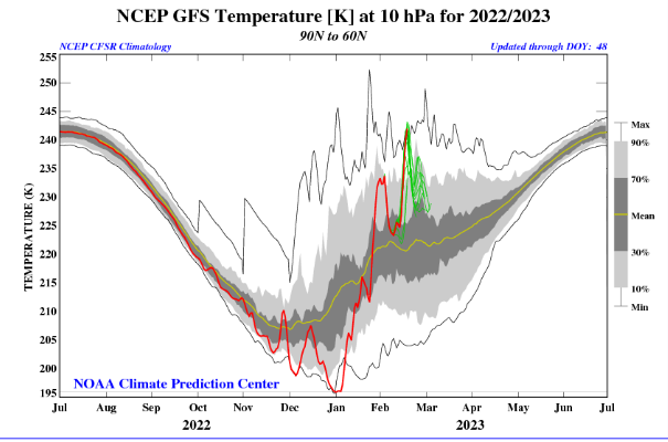
A sudden stratospheric warming is a significant disruption of the stratospheric polar vortex that begins with large-scale atmosphere waves (called Rossby waves) getting pushed higher into the atmosphere. These waves can “break” (like waves in the ocean) on top of the polar vortex and weaken it. If waves are strong enough, the winds of the polar vortex can weaken so much that they can reverse from being westerly to easterly. This leads to cold air descending and warming rapidly, with the red line on the graph showing the sudden jump in temperature.
This can lead to a displacement or splitting of the polar vortex, so instead of cold air being locked above the polar region, it can push further south into the mid-latitudes.
January Stratospheric Warming
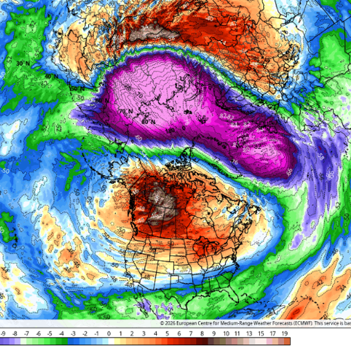
Now that you know what stratospheric warming is, what're the signs that one could be looming around a week and a half to two weeks from now around January 17th. When we look at temperatures in the stratosphere, you can see in data the cold air descending and warning rapidly and that cold air surging into North America.
You can see that air still lasting through at least January 20th.

This would put us into northwest flow, which is notorious for allowing colder patterns to move into our area. That looks like a potential with this event if it happens.
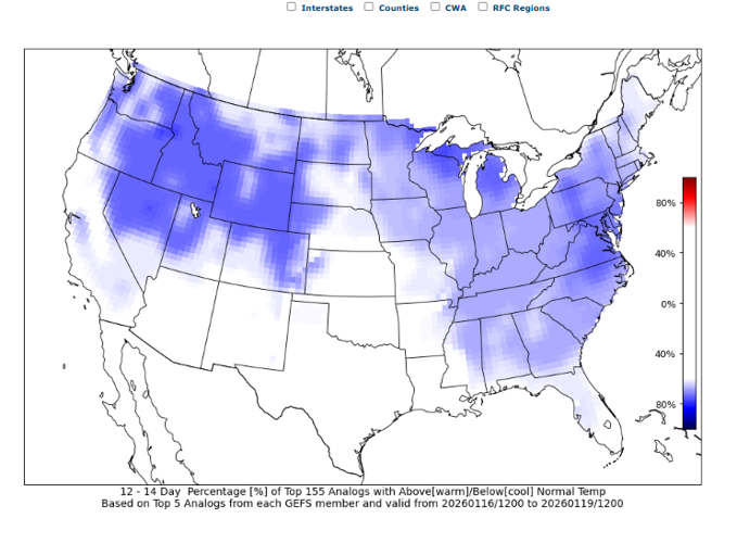
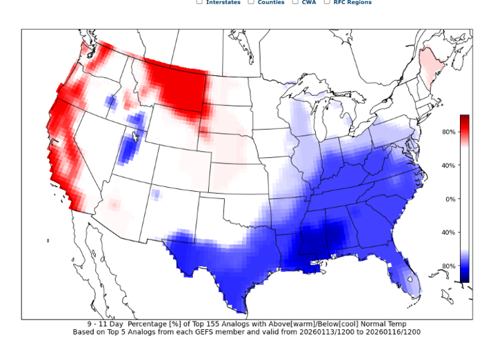
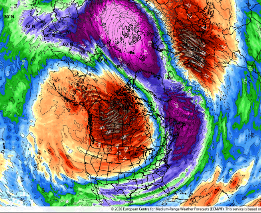
Why else are we confident this could happen? Well when we look at extended analogs, we can also see signs of that colder pattern potentially getting ready to roll into our area. Take a look at the 9-11 and 12-14 Day temperatures compared to normal from CIPS analogs.


You can obviously see the colder air rolling into our region, valid for January 13th-20th.
What we are unsure on this far out is how high of an impact that cold air will have and where the coldest air associated with it will end up in North America. Is it possible it ends up right over us and we go down to single digits? Not impossible. Is it possible it just brings us into a longer, colder pattern, but not extremes? Also possible.
That's something that we will be watching over the next couple of weeks!


