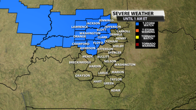
The NWS Storm Prediction Center has issued a
* Severe Thunderstorm Watch for portions of
Southeast Illinois
Southern Indiana
* Effective this Sunday night from 610 PM until Midnight CDT.
* Primary threats include...
Scattered damaging winds and isolated significant gusts to 75
mph possible
Isolated large hail events to 1.5 inches in diameter possible
SUMMARY...A cluster of intense thunderstorms has formed in southeast
Illinois. These storms are expected to track southeastward this
evening across the watch area. Damaging winds are the main concern.
The severe thunderstorm watch area is approximately along and 40
statute miles north and south of a line from 30 miles south
southwest of Mattoon IL to 30 miles north northeast of Louisville
KY. For a complete depiction of the watch see the associated watch
outline update (WOUS64 KWNS WOU3).
PRECAUTIONARY/PREPAREDNESS ACTIONS...
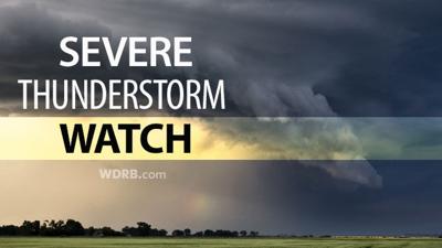
REMEMBER...A Severe Thunderstorm Watch means conditions are
favorable for severe thunderstorms in and close to the watch area.
Persons in these areas should be on the lookout for threatening
weather conditions and listen for later statements and possible
warnings. Severe thunderstorms can and occasionally do produce
tornadoes.
Reach meteorologist Matthew Wine at mwine@wdrb.com, on Twitter or on Facebook. Copyright 2025. WDRB Media. All rights reserved.


