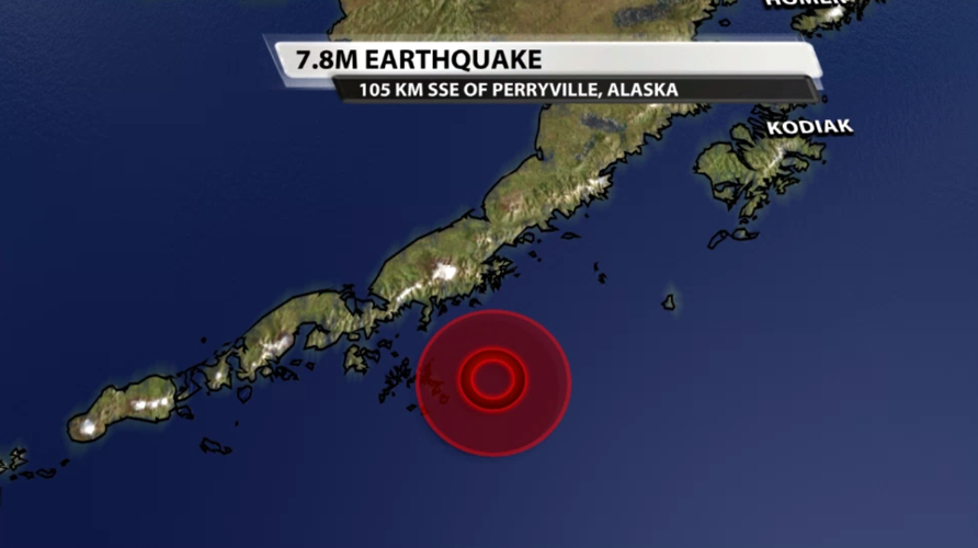
Early Wednesday morning our time (late Tuesday night local time) a magnitude 7.8 earthquake occurred more than 100 km southeast of Perryville, Alaska, in the Alaskan Peninsula.

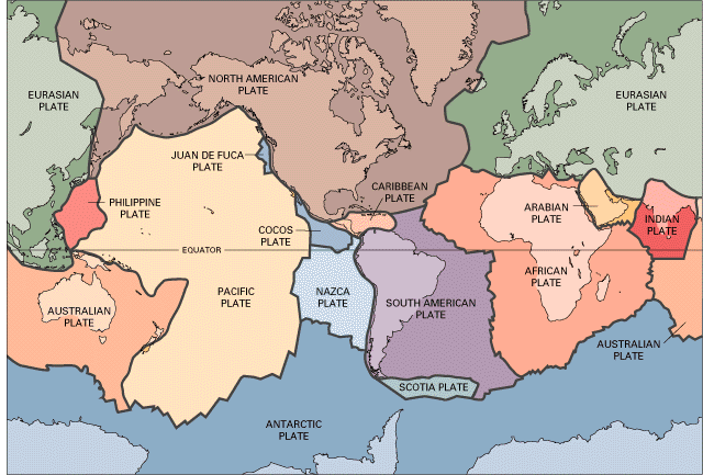
According to the U.S. Geological Survey, this strong earthquake was "the result of thrust faulting on or near the subduction zone interface between the Pacific and North America plates." Here's what happens in a thrust fault, so you can get a better idea of what the earth did this morning in Alaska:
This is actually a pretty common place to have earthquakes, and there have been half a dozen strong earthquakes in this area in the last century. A Tsunami Warning was initially issued around 2:20 AM EST for South Alaska and the Alaskan Peninsula. About two hours later the Tsunami Warning was canceled. It would appear the tsunami threat did not materialize as expected so the U.S. Tsunami Warning System canceled the warning.
Even though the tsunami threat didn't materialize, there was a ripple effect from this strong earthquake. IRIS Earthquake tweeted a thread about "waves" that extended out from this earthquake in Alaska - check out this animation!
Watch the waves from the M7.8 Alaska earthquake roll across seismic stations in North America! #AlaskaEarthquake (THREAD) pic.twitter.com/GOcPFbduy7
— IRIS Earthquake Sci (@IRIS_EPO) July 22, 2020
IRIS (Incorporated Research Institutions for Seismology) is a university research consortium studying, among other things, earthquakes. As the tweet thread explains, you are looking at a ground motion visualization. If you throw a rock into the water, the ripples created at the spot where you threw the rock in are large. Then the ripples spread out from the center and get smaller and weaker the farther away they move. The same thing happens with the Earth, and that's what you're seeing here. Not all of the "waves" you see in the animation are strong enough to be felt by people on the surface of the Earth, but "sensitive seismic instruments" can pick up the movement.


