
With the rain finally coming to an end, we've got a fairly cool afternoon to end off our Sunday. Today will be the coolest day for the next few though because we are going to start warming up quickly.
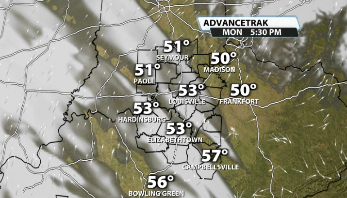
For President's Day tomorrow, we'll start off with a lot of cloud cover, but it probably won't end that way. We should thin out some clouds and get some sunshine out of them by late afternoon. This should bring our temperatures up into the mid 50s.
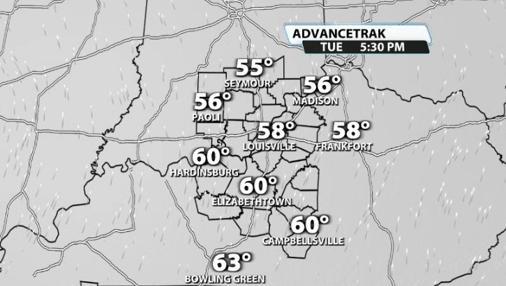
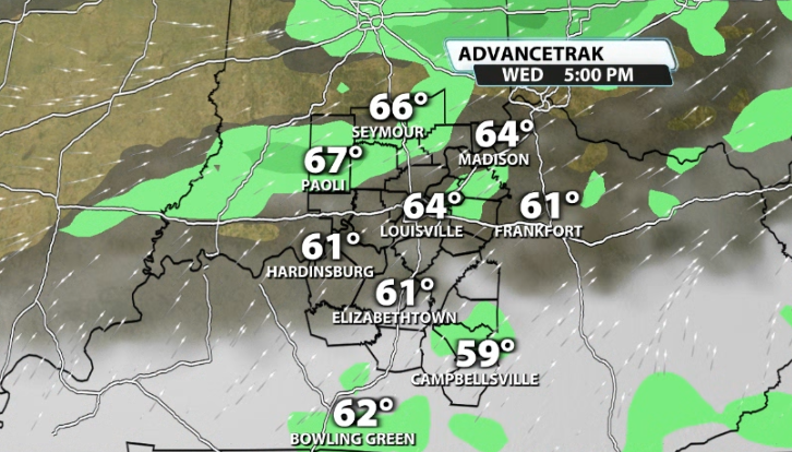
We keep climbing the temperature ladder through the week. By Tuesday, we return back into the low 60s and by Wednesday we're back in the upper 60s. Rain and storm chances start to creep on in by the middle of the week, but mostly in scattered form for Wednesday.
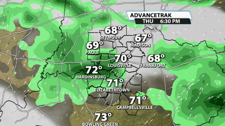
Rain and storm chances do look like they may be coming up more for later in the work week, specifically Thursday and Friday. We should be back to near 70 or so for a good chunk of our area by Thursday. This will provide enough warmth to get some scattered showers to turn into scattered thunderstorms by Thursday night and heading into Friday.
Since we are so warm, it's worth watching to see if any of those storms could get on the stronger side later this week, but we are way too far away to talk about the specifics if that were to happen. That will be something we monitor through this week. Have a great end to your weekend!


