
Typically starting in the month of June we head into what we call "MCS" season. MCS stands for Mesoscale Convective System. Okay...so....what is it?
An MCS is a complex of thunderstorms which becomes organized on a scale larger than the individual thunderstorms, and normally persists for several hours or more. MCS's may be round or linear in shape, and include systems such as tropical cyclones and squall lines.
There is a good potential for a very strong MCS to develop just to our north on Wednesday evening. This has already prompted a "moderate" (4/5) risk for severe storms for parts of Illinois and Indiana. Here, a tornado outbreak is looking more likely. For our area, we are clipped partially by the Slight(2/5) risk for severe storms.
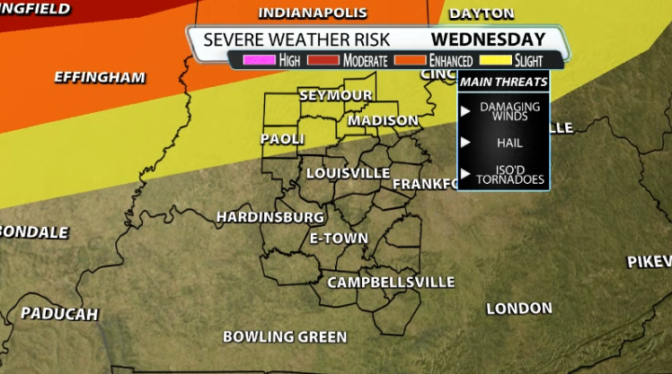
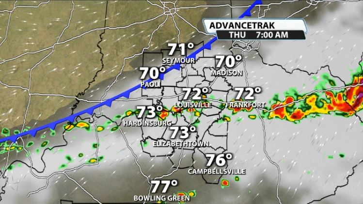
Late Wednesday night/early Thursday morning, that MCS will be diving southward toward our area. While we are not in the highest potential for severe weather, we could still see our fair share of impacts. The line will still be packing a decent punch and it rolls from north to south across our Indiana counties.
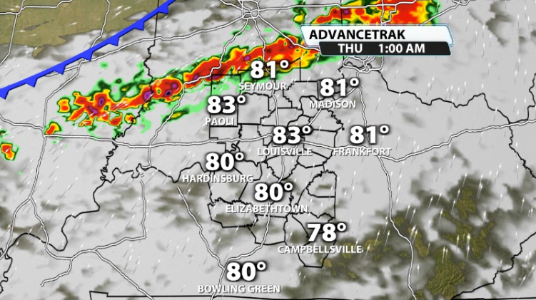
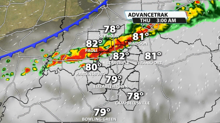
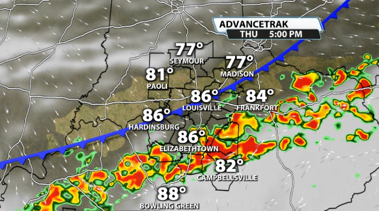
The question becomes, how far south can that line make it at that strength? You can see data still has this line pushing through Louisville and south, but at a weaker state by then.
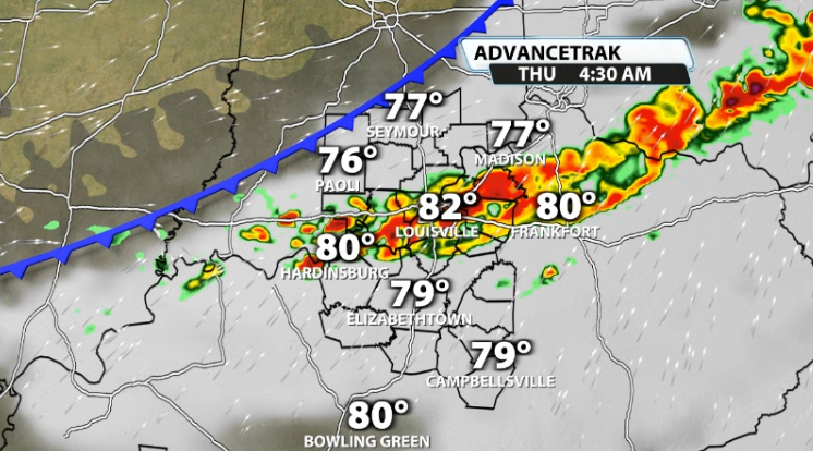
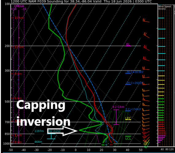
There are some limiting factors that could help keep the main severe risk north of the river and limit how strong the storms can stay by the time they cross the river. One of those is what's called a "cap". You may have heard us refer to this before. If not, here is a good explanation.
Essentially, a cap is an area of warm, stable air around a mile or so up in the atmosphere that acts as a "lid" and suppresses storms from getting to their true potential. It essentially limits what storms can do. In data, some, not all, but some, show a capping inversion over us that could help limit how far south those storms make it.

What also might help us is that it is coming in very late at night when we are limited on warmth because of loss of daytime heating. This can help lower storm energy.
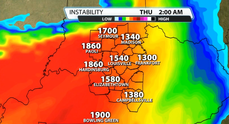
With that being said, it doesn't get rid of storm energy. With southwest winds picking up a lot through the day, that increases low-level moisture and keeps temperatures mild, which allows for there to still be a decent amount of energy available if we don't mix the dew points down.
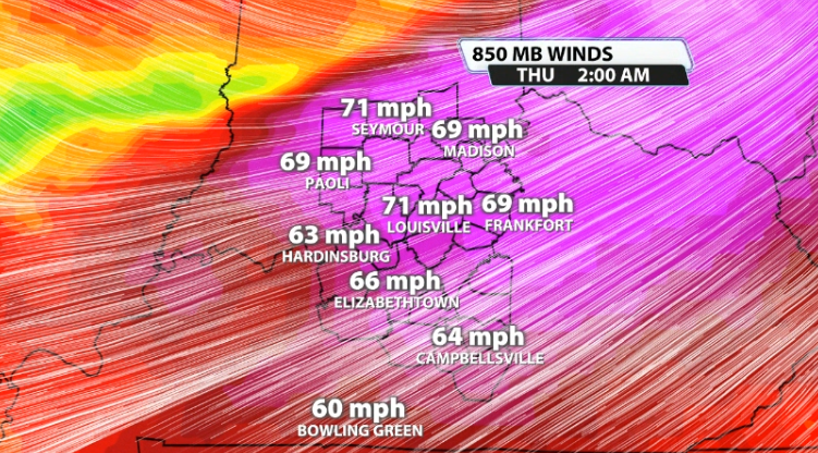
The wind energy (we typically look for 40mph or stronger at the 850mb level of the atmosphere; about a mile above the ground), is very sufficient. We typically see this much wind energy in a spring set-up, not so much during the summer. There's no doubt we have plenty of wind energy available.
By Thursday afternoon, it is possible we see a flare up of more storms, mainly south of Louisville. With daytime heating a few of those could end up being on the stronger side as well.