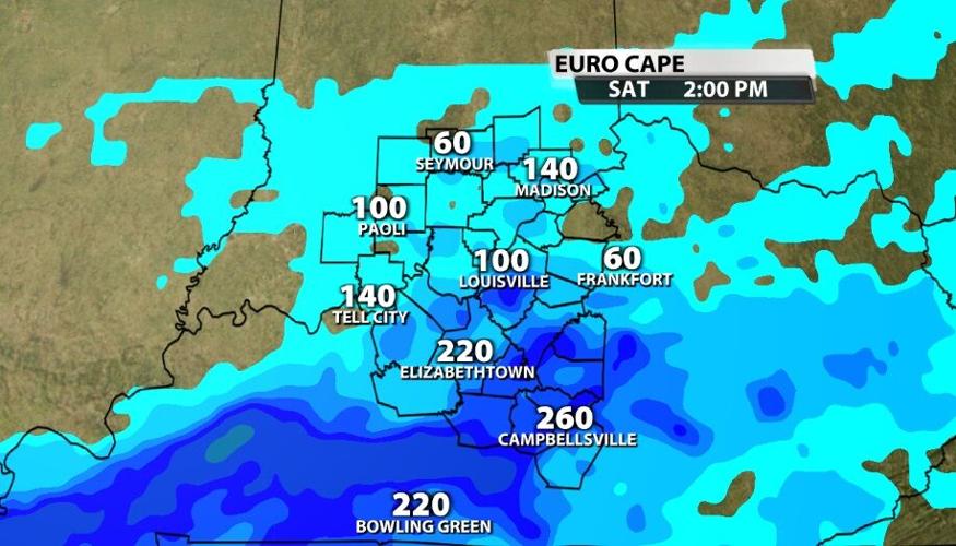

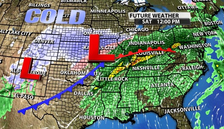
A strong low pressure center, with warm and cold fronts attached, will move through our area this weekend bringing heavy rain and the threat of severe storms. This post is broken down into a discussion of the possible risk of severe storms, the much more likely threat of flooding and heavy rain, and the timing of everything.
SEVERE RISK
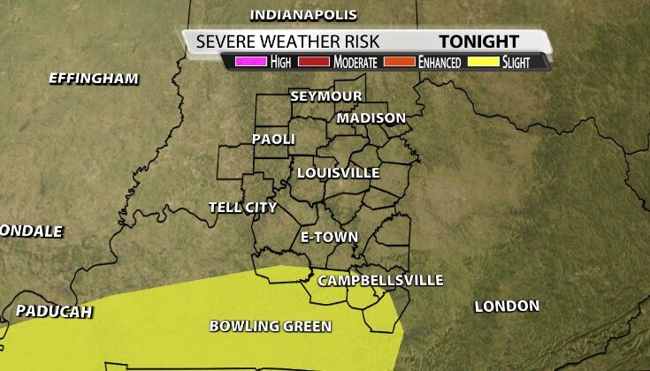
The Storm Prediction Center has placed only our far southern communities in an elevated threat of organized severe storms Friday night. Keep in mind, though, this storm system impacts us late Friday through the day Saturday.
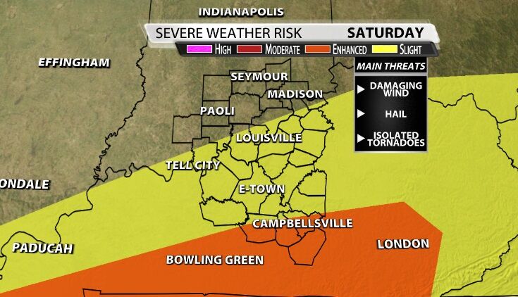
All our communities around and south of the river have been added to the Slight risk of severe storms on Saturday - that's level 2 out of 5. Our far southern spots are again at a higher risk of storms, level 3 out of 5 (in the orange color).
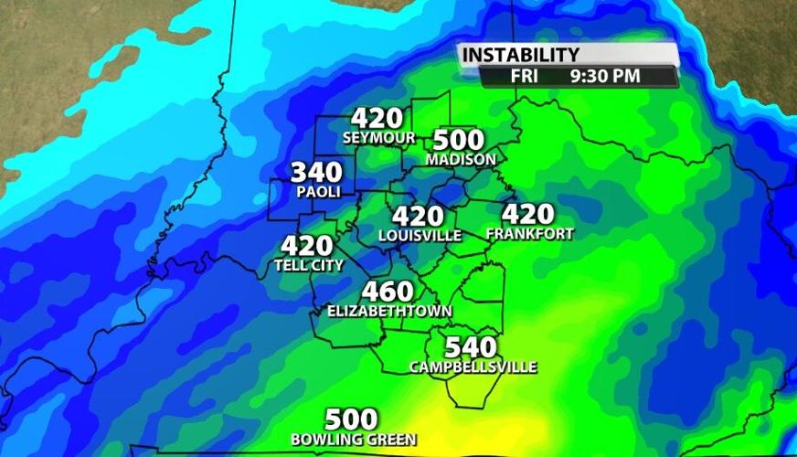
Here in Kentuckiana we have better ingredients for severe weather Friday evening, but the timing doesn't look like it will line up correctly to produce those storms. After building heat and humidity through the afternoon, we have higher (though not high) instability Friday night than we will on Saturday.

While instability looks insufficient on Saturday to produce severe storms here, there have been a couple forecast models that keep bringing those stronger storms here with each new update. If the rain breaks apart and we get more dry time or even time with some sunshine Saturday, that will help boost the instability and give the later storms more energy to work with.

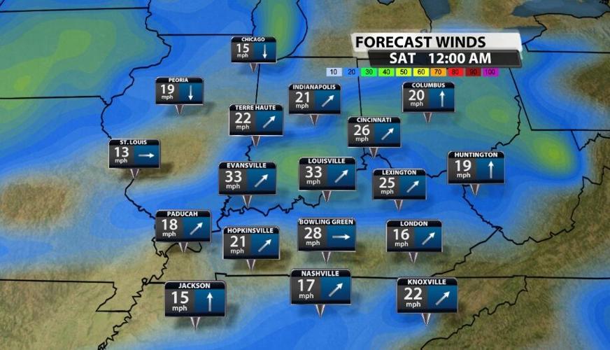
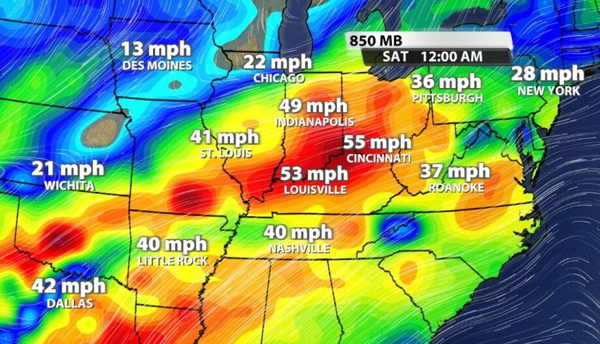
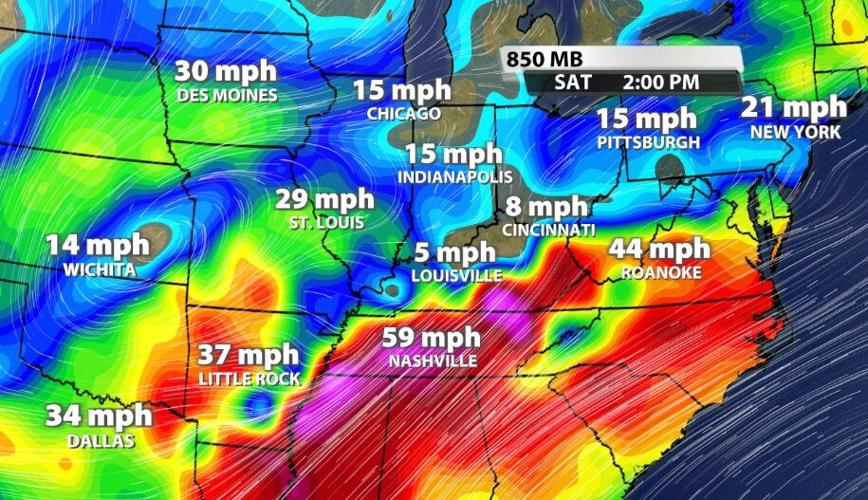
The low level jet shows a really interesting picture of ingredients being better Friday in Kentuckiana but not lining up quite right with the storms. There will be a jet streak in place over our heads late Friday night with wind speeds 50-55 mph. That could add some power to storms down here near the ground, but it doesn't last very long.

By Saturday that jet streak has moved out of our area and another one has developed south of here. That's where the wind will provide more support for strong and severe storms. The wind is still strong in the upper levels, where the jet stream is found, but isn't providing additional forcing to this system beyond that.

With that in mind the wind will still be strong. Gusts outside thunderstorms will be up to 30-35 mph and inside storms could be as strong as 60 mph. That is strong enough to do damage. Isolated tornadoes and hail will also be possible in this setup, but those two threats are lower.

This is our first real threat of severe weather after the devestating tornadoes in western Kentucky (and several in our area) on December 10 and 11. A question on many minds today is "could this be like three weeks ago?"
First, what happened on December 10-11 was historic. The chance that repeats itself only weeks later is incredibly low, and I am not expecting anything here like what happened in western Kentucky. But the forecast isn't simply based on statistical odds. So second, the tornado threat tonight/tomorrow is conditional, meaning a lot of things will need to come together perfectly for us to see any tornadoes. Our instability is very limited (discussed above) and will stay limited if we get all this rain. If we get breaks in the rain tomorrow and the instability builds, our tornado threat rises. We don't have the same intensity of wind shear like we did a few weeks ago, not even close (also discussed above). The better wind shear is south of here which is part of the reason the Storm Prediction Center is highlighting areas south of us as being at the highest risk of severe storms and tornadoes. Third, the ingredients I'm looking for when forecasting tornadoes are:
Shear ❌
Lift ✅
Instability ❌
Moisture ✅
Three weeks ago western KY had all of these, and the icons above show you what we have and don't have this weekend. Even if you have all of them, sometimes you don't get tornadoes. We do have lift, provided by the fronts and the center of low pressure passing through our area. And we have plenty of moisture which is a nice transition to our discussion of the heavy rain threat.
FLOODING & HEAVY RAIN
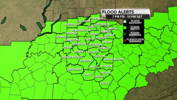
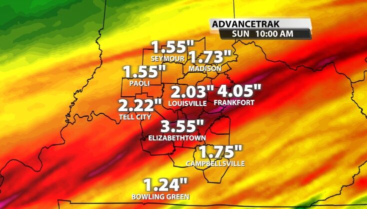
Heavy rain leading to flooding is my main concern with this system. Across our area 2"-4" of rain will be likely with some spots able to see even more than that. A Flood Watch is in effect for all our communities through the end of the day Saturday. With this much rain in about 20 hours, it's likely we will see flooding somewhere in our area. Never drive through water over the road; it's not safe. If you can't see the paint on the road under the water, turn around and find another way to get where you are going.
TIMING
Heavy rain and thunderstorms ramp up after dark tonight. We have already see a few isolated storms in our area today, but there will be many more of them after the sun sets. Please keep this in mind if you have plans to celebrate the new year late into the night.
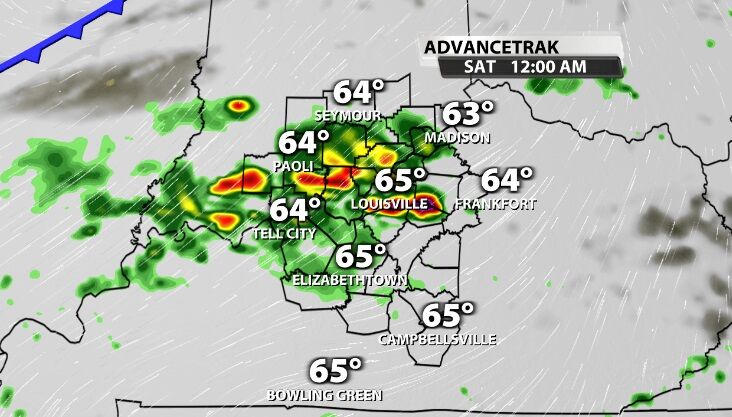

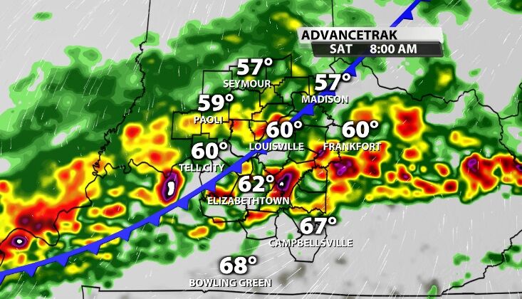
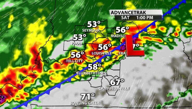
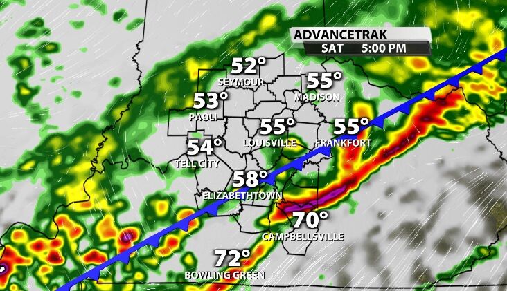
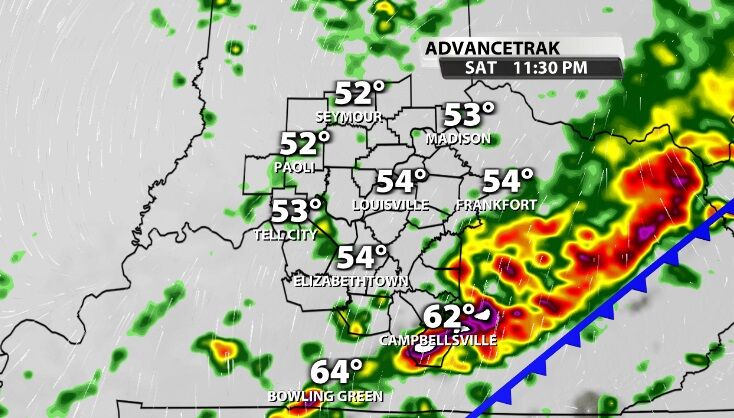
Overnight and through much of the day Saturday, we will see more heavy rain and scattered storms.
Join Rick Deluca on WDRB News tonight for updates on this forecast and Jude Redfield for WDRB in the Morning from 6-9 AM to see where the heaviest rain is setting up and how our storm threat has evolved.


