The National Weather Service office in Louisville hosted a conference call with their partners about the threat of flooding and severe storms in our area this weekend. They host these calls for higher level weather events that are more complex or more impactful than just afternoon thunderstorms. Here's what we talked about:

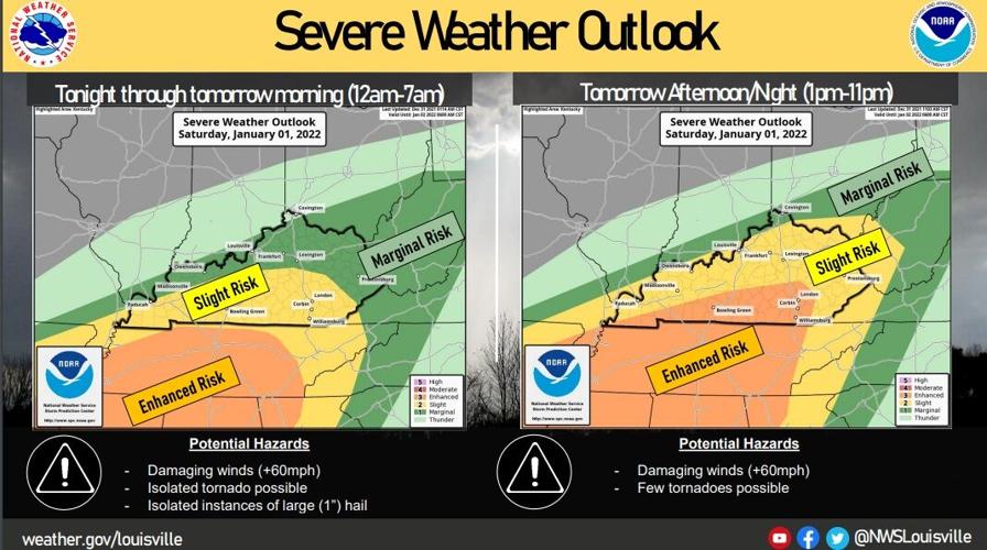
Tonight is mainly rain and thunderstorms. The main threats will be wind gusts up to 60 mph and isolated tornadoes if storms become surface-based. Isolated hail could be possible, too, as a warm front moves north out of TN. If that gets into southern KY, that's where the threat of tornadoes and hail would come into play.
Tomorrow is more challenging. That warm front should lift north through the state tomorrow, but just how far north it gets is the issue. Global models only bring it to roughly the Parkways. Short-range models move it closer to the river, but most recent updates from those models start to bring it back down to the Parkways. That more northward extent is why the SPC brought the slight risk up to the Ohio River Saturday.
When the cold front arrives Saturday afternoon and pushes into that warmer air, stronger storms may develop in one or two lines. Damaging wind gusts and isolated tornadoes will be possible in those lines. There will likely still be changes in the data overnight, so it's important to check the forecast again tomorrow morning.

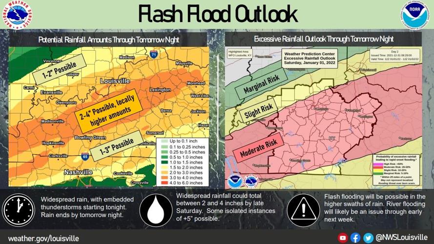
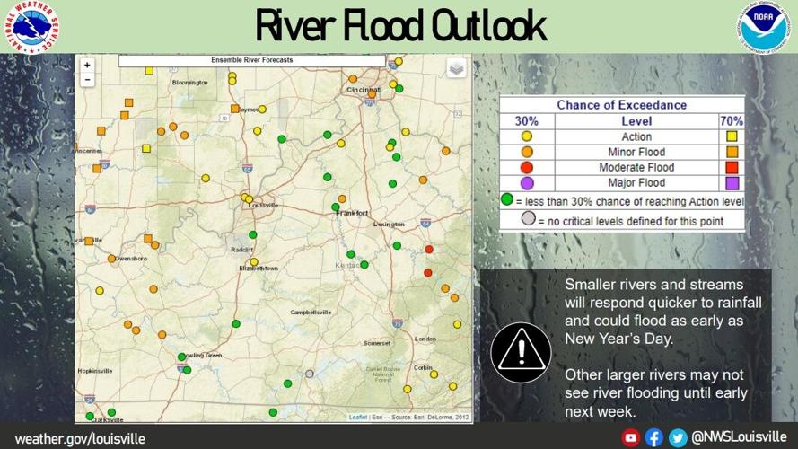
Heaviest axis of rainfall looks just north of the W KY and BG Parkways. !'-2" of rain will be possible tonight and another 1"-2" is possible Saturday with some spots seeing even more. The NWS is monitoring area river levels (image below) as river flooding will be an issue in addition to flash flooding caused by storms.

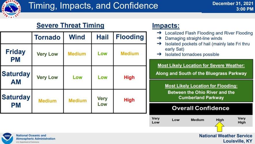
Again, here is the break down of the threats expected with the timing. We are confident in the heavy rain part of this but less confident in how strong the storms will be.


