
The coldest air we have felt this season is moving in right around Halloween. A slow-moving cold front brings rain first this weekend; check out the post below for more info on the incoming rain.

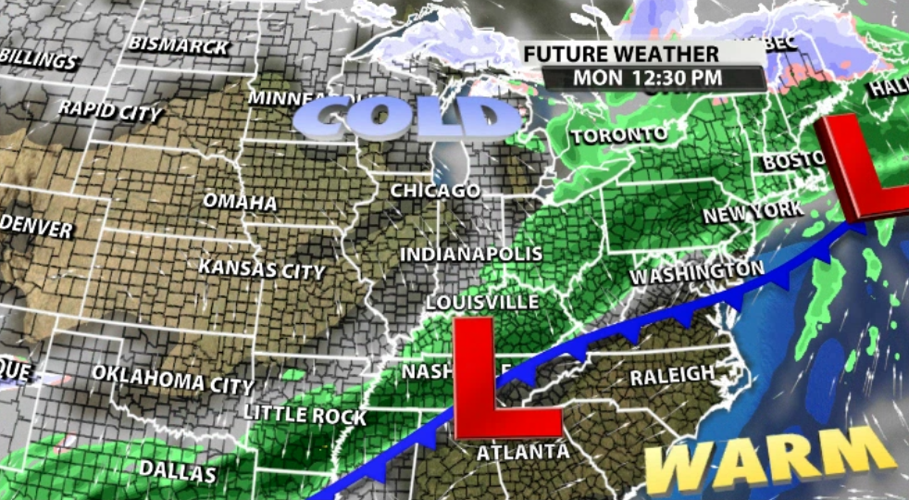
This weekend a stationary cold front controls the weather across our region. Right now that front is positioned north of us.
A cold front acts like a wall separating two different kinds of air. Right now we are on the warm side of this front, but colder air waits for us on the other side. As the cold front passes through our area, it will change the wind direction. Right now the wind is moving in from the south bringing warmer air. After the front passes, the wind will move in from the north and northwest where the air will be much colder.

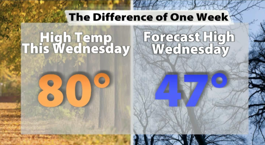
After high temperatures near 80 degrees for the last few days, high temperatures will drop down to the 40s next week. That's how strong the temperature difference is between the two sides of this cold front.

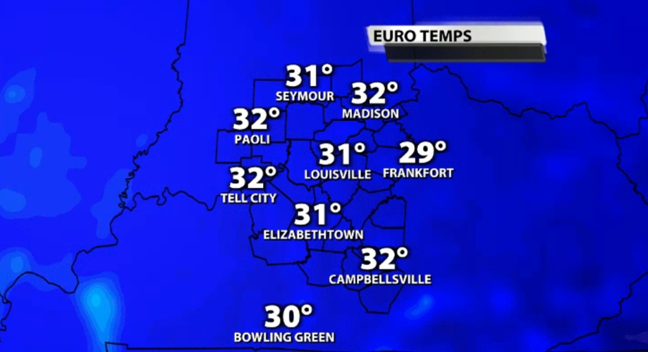
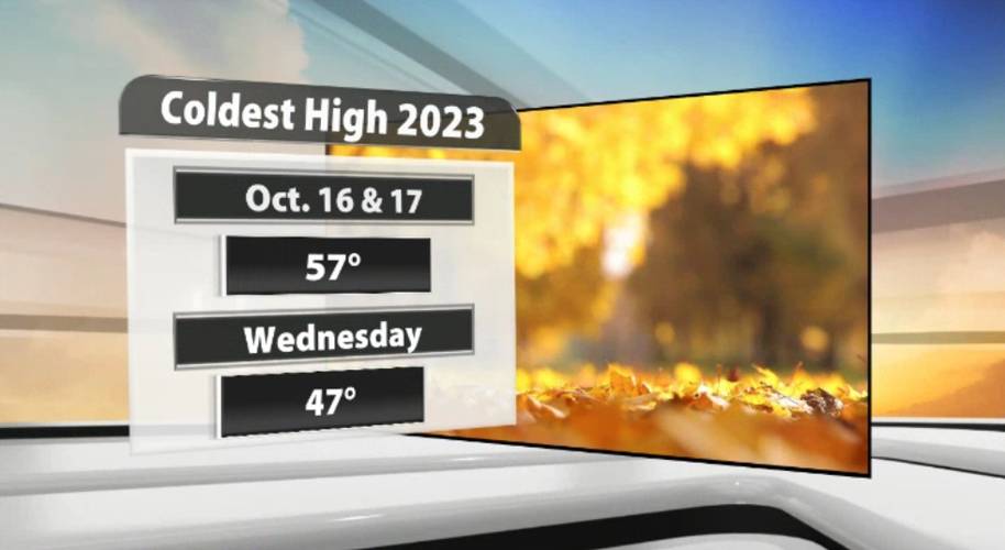
The coldest high temperature Louisville has recorded so far this season is 57, so our forecast high of 47 next Wednesday will be a good bit colder.

The low temperatures will be even colder. These temperatures Wednesday morning should end the growing season across Kentuckiana, so be prepared for a Freeze Warning to come out between now and then.

While the cool-down starts Monday, Tuesday and Wednesday will bring the coldest air from this system. That means those of you trick-or-treating or going to a Halloween party Tuesday night should be prepared for a cold night.


