The Storm Prediction Center has upgraded the risk of severe storms in parts our area. They have added the orange Enhanced category, which is level 3 out of 5, in our western counties.
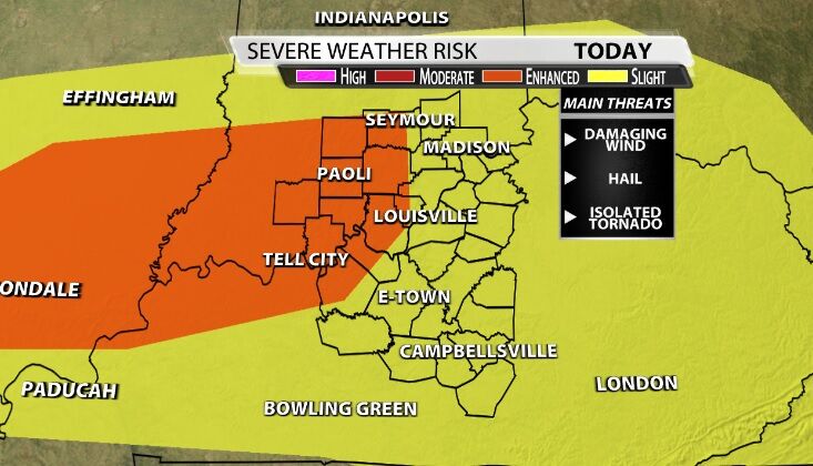
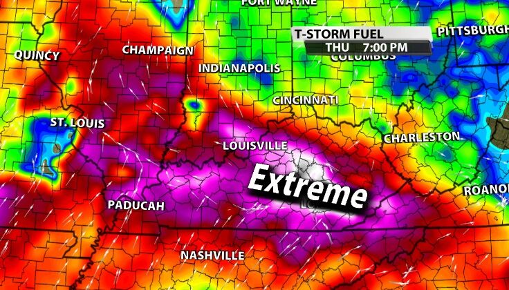
We have more storm energy to work with today which supports a threat for hail in addition to the main concern about damaging wind. Isolated tornadoes are also on the table with so much power in the atmosphere. This is still a conditional setup with "up" potential, meaning *if* these storms grow, they could become very strong very quickly.
TIMING
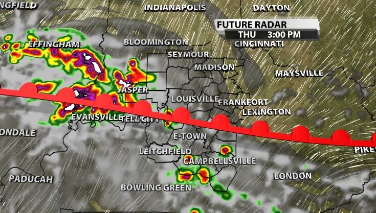
Storms have already started popping up, so the timing is now through midnight. The warm front in these images is the "boundary," the disturbance in the atmosphere that gives storms a chance to pop up. If they pop up in the right spots, they will be able to grow stronger.
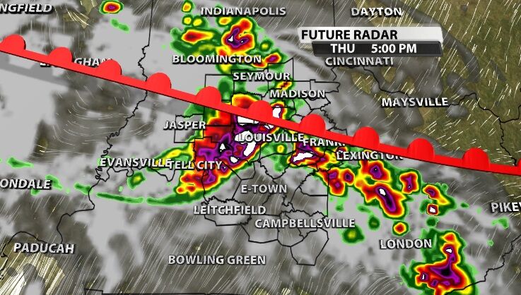
Strong wind is the main threat with hail and isolated tornadoes also on the table. Heavy rain leading to flash flooding will be something we need to keep an eye on, especially in places that saw a lot of rain yesterday or don't drain well. Frequent lightning, like Wednesday, will also be a threat.
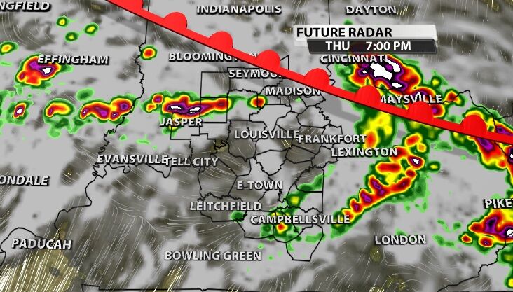
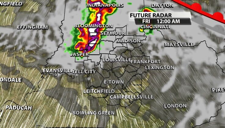
This cluster of storms that moves through central and southern Indiana just before midnight has been just about the only consistent part of the data. This round will also bring strong wind gusts, heavy rain, and thunder/lightning.
Tune into WDRB News beginning at 4 PM to hear our latest thoughts on how these storms are developing and see the new data about where they are headed.


