
This weekend looks great! It's cooler today, but we've got a lot of sunshine! Temperatures warm up from the mid 50s Saturday to near 70 for the high Sunday. The longer range forecast though does look a little different. With the new pattern that we're in, the high pressure dome that brought in heat to the West coast is weakening. That means any disturbance coming off the west coast will have access to Gulf moisture and will set up a wet end to the week.
By the time we get to Tuesday, we've warmed back up into the low-mid 80s. Like the last couple weeks, a front will put an end to that and bring in storms by Wednesday.

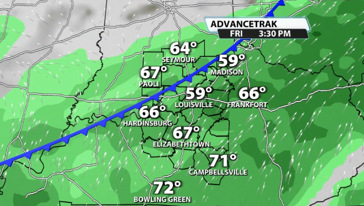
We don't get rid of the rain that easily though. Another disturbance rolls through on Thursday and Friday that could even linger a front over our area. If that does happen, it would allow more rain to fall and add up pretty quickly.
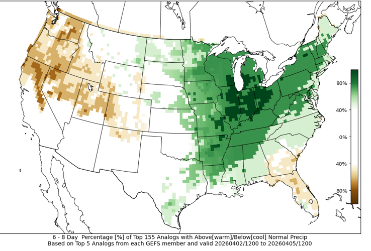
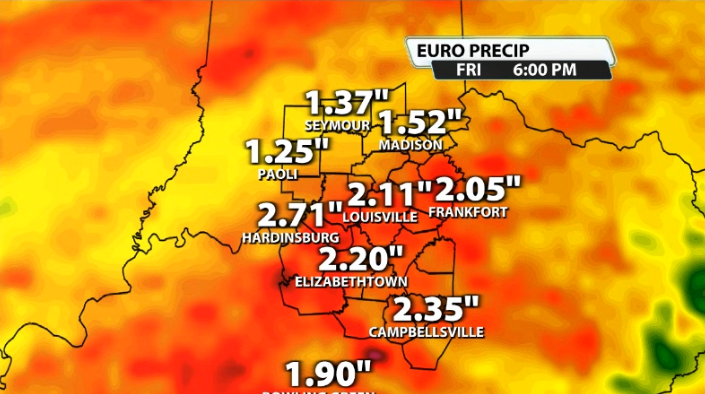
You can see CIPS analogs also picks up on the above average rainfall expected over the next 6-8 days. It shows nearly a 100% chance of that happening in our area for that timeframe.

Most data shows around 1-3" of rain expected by the end of the work week and heading into the weekend. This likely won't cause many flooding issues, but it can help out some of our area that is abnormally dry and on the brink of a small drought.


