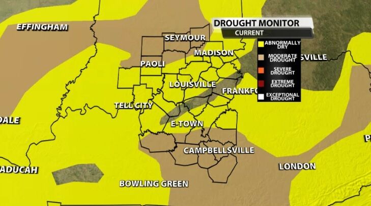
Though we have seen improvement in recent weeks, dry conditions still cover almost our entire area. Communities in our northern and southern ends are in Moderate Drought with much of our area still considered Abnormally Dry by the U.S. Drought Monitor.
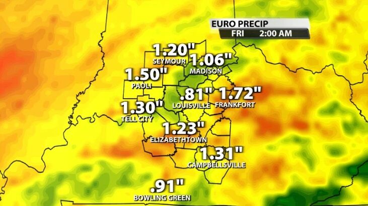
Rain is on the way that should help alleviate the dry conditions because we are expecting one to two inches of rain in our area between now and Friday morning. That much rain falling over several days gives it time to soak into the ground as the ground thaws out after such a deep freeze.
For our far northern communities, this may start briefly as freezing rain late Monday night. With temperature near freezing and light precipitation to start, we can't rule out the possibility, but the best chance for that to happen is in northern and central Indiana.
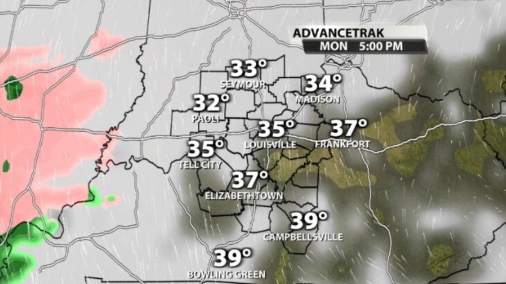
As more rain moves in and the rain gets heavier, that chance for freezing rain dwindles. Temperatures should stabilize in the middle 30s overnight between Monday and Tuesday.
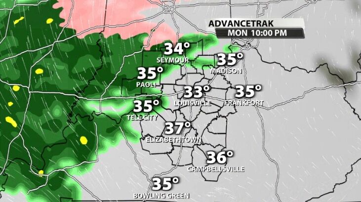
By Tuesday morning the rain becomes widespread. Everyone in our area will see rain this week, but it won't rain on you constantly from Tuesday morning through Thursday night. This will be more off-and-on than that.
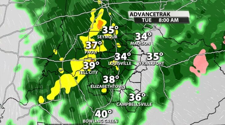
Tune into WDRB News tonight at 10 to see the latest data on the freezing rain potential and timing of the heaviest rain in your area. We'll go through that together hour-by-hour so you know what this week brings.


