
It's another busy weekend in Kentuckiana with UK playing at home and booth days in full swing at Harvest Homecoming, just to name a few things going on. We are expecting some rain in the area this weekend, but the whole thing is not a washout. Read on to see when rain is most likely and how to plan your weekend around it.
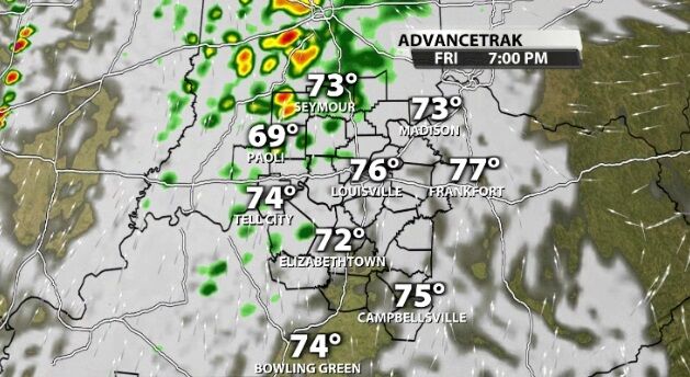
As an upper-level low pressure center moves north of us Friday, it will start to generate some rain in our area late in the day. Most of Friday should stay dry, but these showers will move in around sunset and continue off and on through Saturday morning. This won't add up to much rain; think about this as more like the light, annoying rain instead of the heavier, beneficial rain we need to help bring us out of drought conditions.
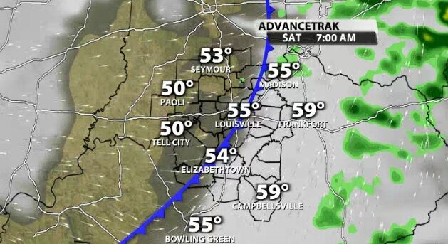
Showers will likely redevelop at some point Saturday evening as the position of the low pressure center shifts, but again, that would be even lighter rain than what we see Friday night.
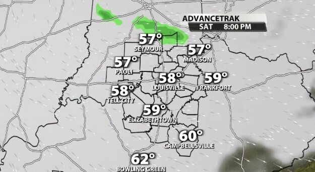
We are also expecting a couple showers Sunday but need to see where the upper-level low is positioned by then to know if they will be here or in eastern Kentucky. Regardless, Sunday will be a dreary, chilly day with a cold breeze, mostly cloudy sky, and maybe these light, drizzly showers. We will continue to update the forecast online and on TV as data pours in.


