
We hit a staggering 96° yesterday afternoon in Louisville since the airport avoided storms that others in our viewing area saw yesterday. Luckily for us, that kind of heat is in the rearview mirror for a bit. Yep that's right, we've got cooler air and drier air on the way for this work week!
We'll have a few lingering showers/storms around our area today. Again, nothing worth cancelling plans over and not everyone will see rain so don't rely on mother nature to feed your lawn.
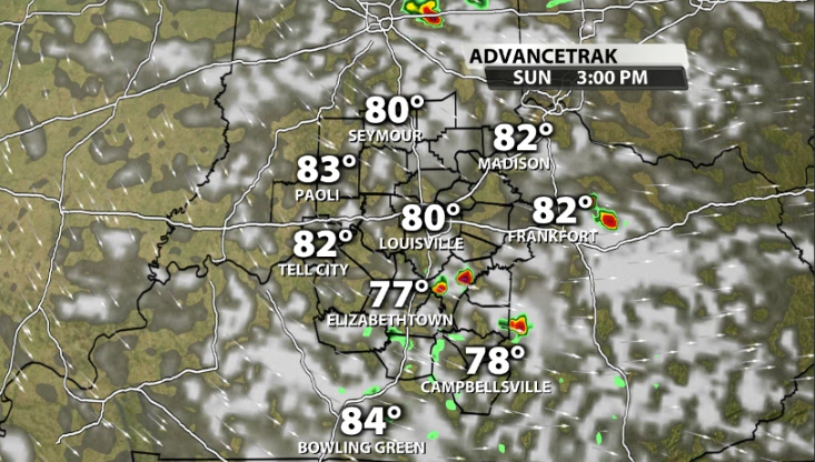
After today, we do not touch a rain chance for at least the next week! The heat isn't going to cause us any issues for the next few days however, instead we've got some early Fall-like temperatures rolling on in!
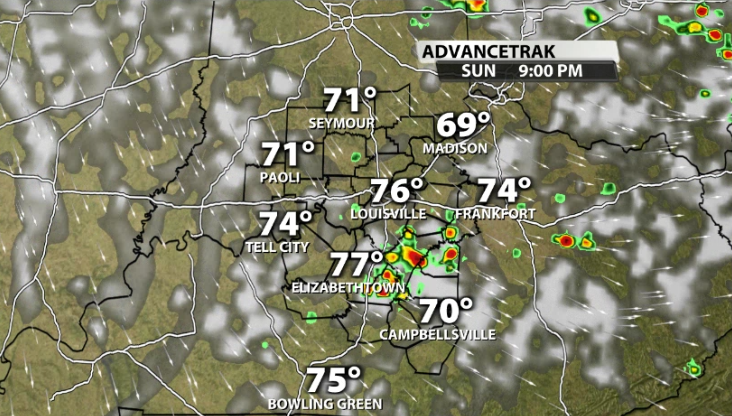
With our winds shifting out of the North and a trough developing over our area, cooler and drier air filters its way in starting Monday. By Monday afternoon, temperatures only reach the low 80s and our humidity will slowly fall the longer we go into the afternoon tomorrow.
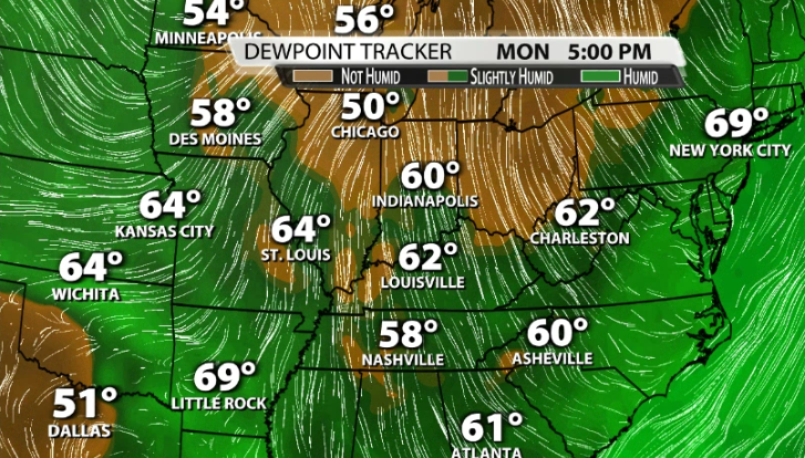
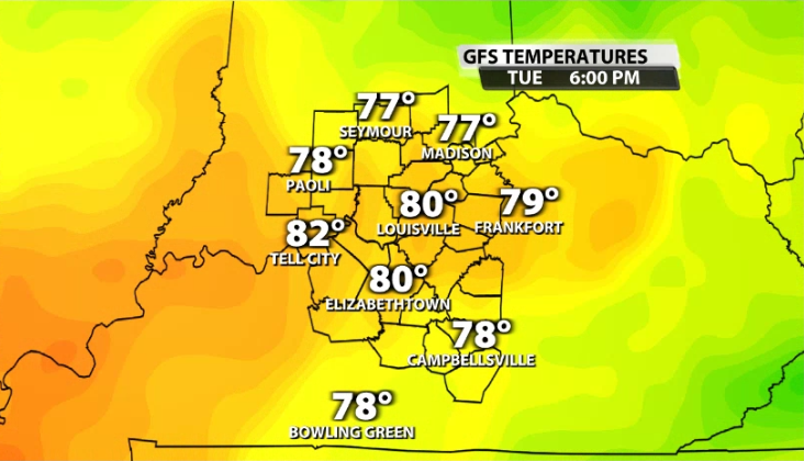
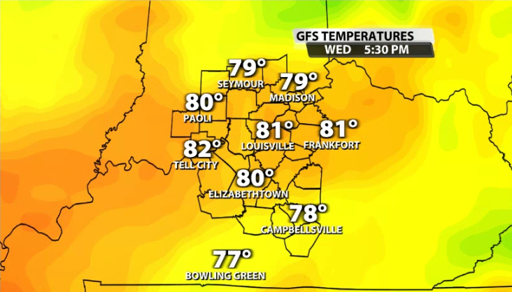
Temperatures still drop and humidity drops further heading into Tuesday & Wednesday. We continue to see more dry air filter its way into our area by Tuesday and with our area still remaining in North and North Easterly flow, our temperatures will struggle to get out of the 70s in most areas!
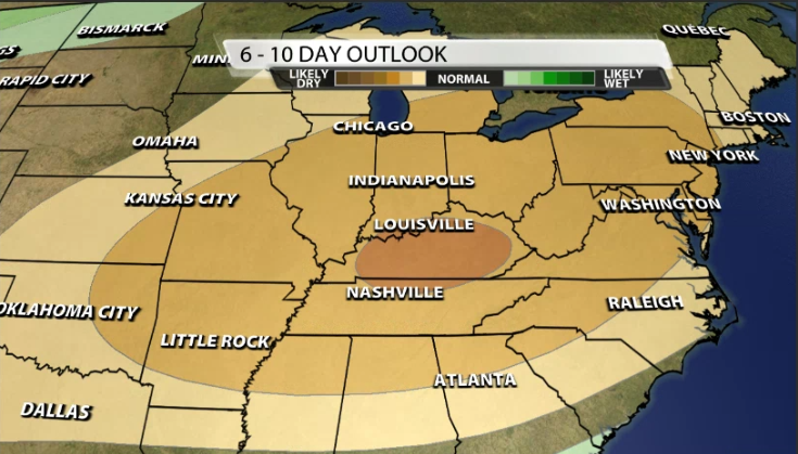
We will slowly build those temperatures back up by next weekend, but that likely will come rain free! The 6-10 Day precipitation outlook from the Climate Prediction Center has us right in the bullseye for the likelihood for below normal rainfall! If you have outdoor plans over the next week, I (Bryce) don't think you could have a better forecast for this time of the year!


