

After morning storms moved through the area bringing heavy rain and frequent thunder and lightning, there is more in store for us later this afternoon and into the evening time.
The storms that end up rolling through later today and tonight have a chance of being strong to severe as well, because of the destabilization of the atmosphere. Daytime heating will aid in the development of stronger thunderstorms after the heat of the day.
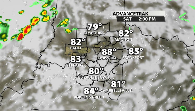
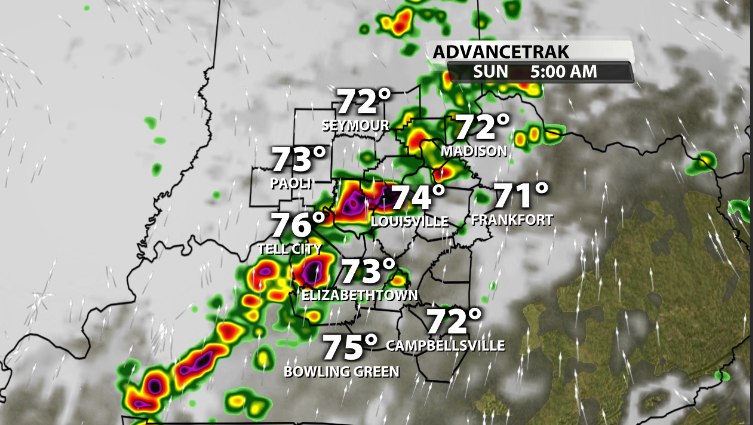
Advancetrak has storms beginning to pop back up again later in the afternoon and heading into the evening time.
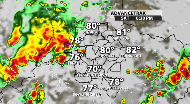
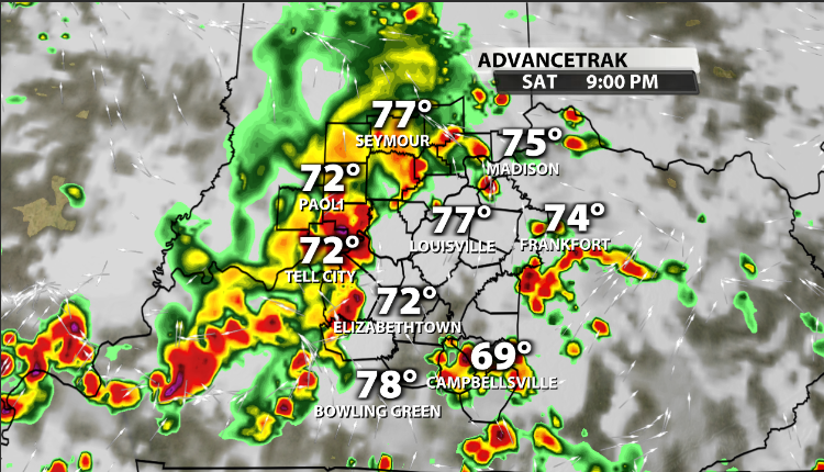
These storms will continue to push through the area in multiple waves through the evening, and some of these storms might be on the strong to severe side.
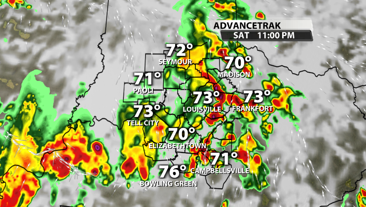
Storms last overnight and into the early morning hours of our Sunday.
When we look at the potential severe weather threat associated with this system, the possibility is there to see a few severe thunderstorms later today. With the daytime heating and drying out potentially for part of the afternoon, the atmosphere will have time to recover from the morning storms, and build up instability.
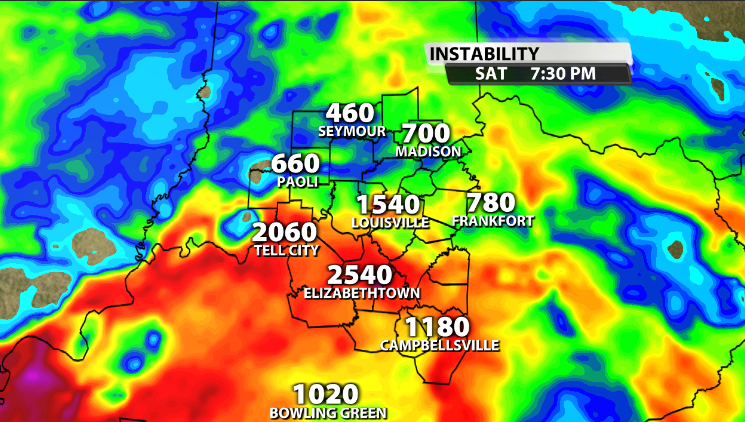
Instability values between 1500-2500 will give plenty of fuel for these storms to become stronger and really get going heading into the evening.
What we have been missing recently around our area when it comes to severe weather potential is wind energy. With the system moving in today, we do have more wind energy, just not a ton.
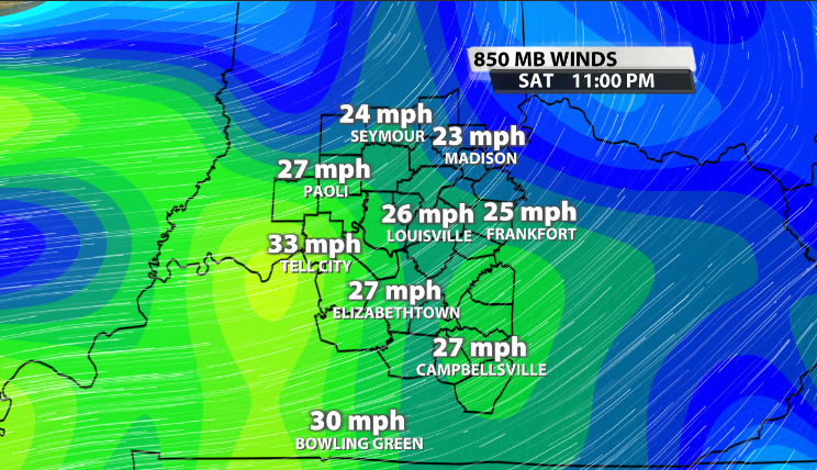
We typically want to see around 40mph at this level in the atmosphere to help sustain strong updrafts within storms. While we do have wind energy higher than we have seen the past few days, this isn't pointing to be a large severe outbreak.
That being said, the SPC (Storm Prediction Center) has put portions of our area in a "Slight" (2/5) risk for severe storms for the rest of the day. The main impacts and concerns would be damaging winds, very heavy rainfall, and small hail.

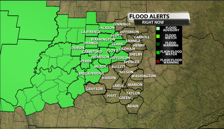
The possibility of this very heavy rain coming down fast at times later today has also prompted Flash Flood Watches from 2pm this afternoon until 8am Sunday morning for the following highlighted counties.
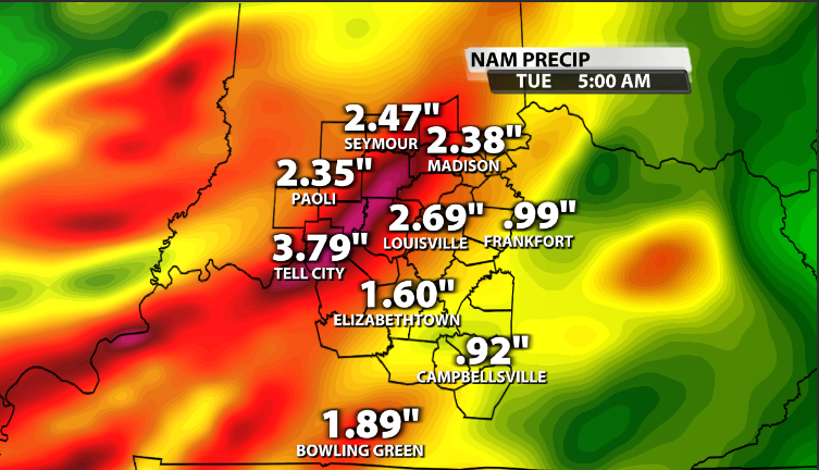
The chance for rain and storms continues over the next few days, and some areas could end up seeing a lot of rain. Some areas could see upward to 3.5-4" of rain by Tuesday. That being said, other areas who don't get hit with the stronger storms could see only between 0.5"-1" of rain.


