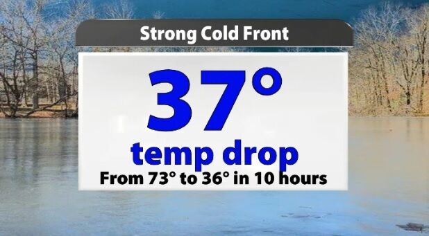
The storms that rolled through overnight came with a strong cold front. Remember a cold front acts like a wall dividing two different kinds of air. Now we are on the cold side of that wall with temperature dropping significantly.
From
To
With rounds of rain in the forecast this weekend, let's take an early look at the timing to help you set your plans.
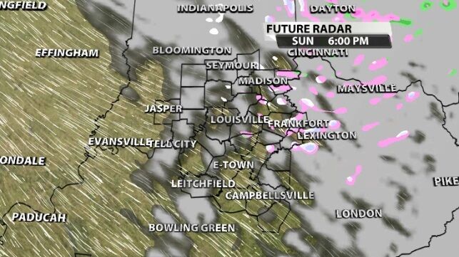
Now that the storms have left our area, we turn our attention to the chance for snow. While Sunday morning's snow chances have dropped to nearly zero, we might see more snow showers late Sunday/early Monday.
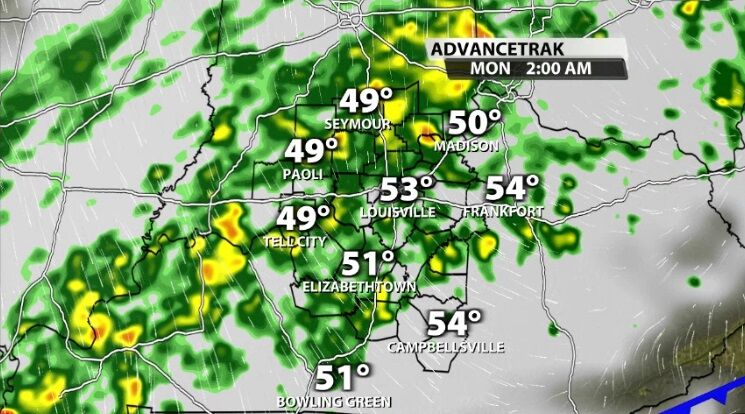
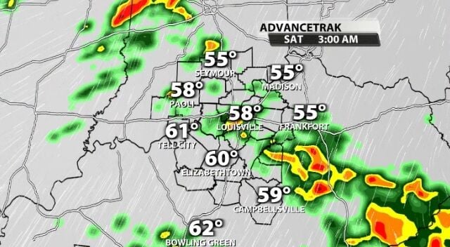
The off and on rain was more on than off Sunday. We saw more rain than dry times, especially as we get farther into the evening.

A cold front is draped across our region and will continue to bring rain for the next couple days. We will go through that timing in more detail:
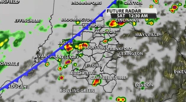
A cold front will pass through our area Saturday morning bringing rain and storms with it before it drops temperatures and humidity. While the weekend does start with rain, it ends with sunshine and much more comfortable air!
Temperatures are feeling less painful this afternoon as warmer air moves into the region. It won't last long, though. The next cold front arrives on St. Patrick's Day and brings some rain with it.
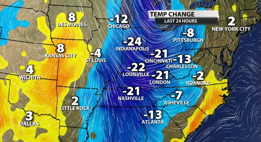
A cold front rolled through our area overnight bringing rain to our communities and now a drop in temperature.

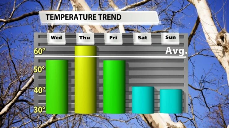
After the last few days have brought lots of sunshine and high temperatures near 80, this cold front is bringing a noticeable drop in temperature. It's not the only one in the next week either.
All eyes are on our next cold front which looks like it will bring a pretty sizeable cool down in the temperature department. But since it's not bringing much of rain chance, let's talk about what a cold front is and what it does for our weather.