
The National Weather Service has issued a Flood Watch for most of our area through 1 AM Eastern Friday. This means you should be watching the weather, flooding may begin in your area within the next few minutes to hours.
From
To
Top Story
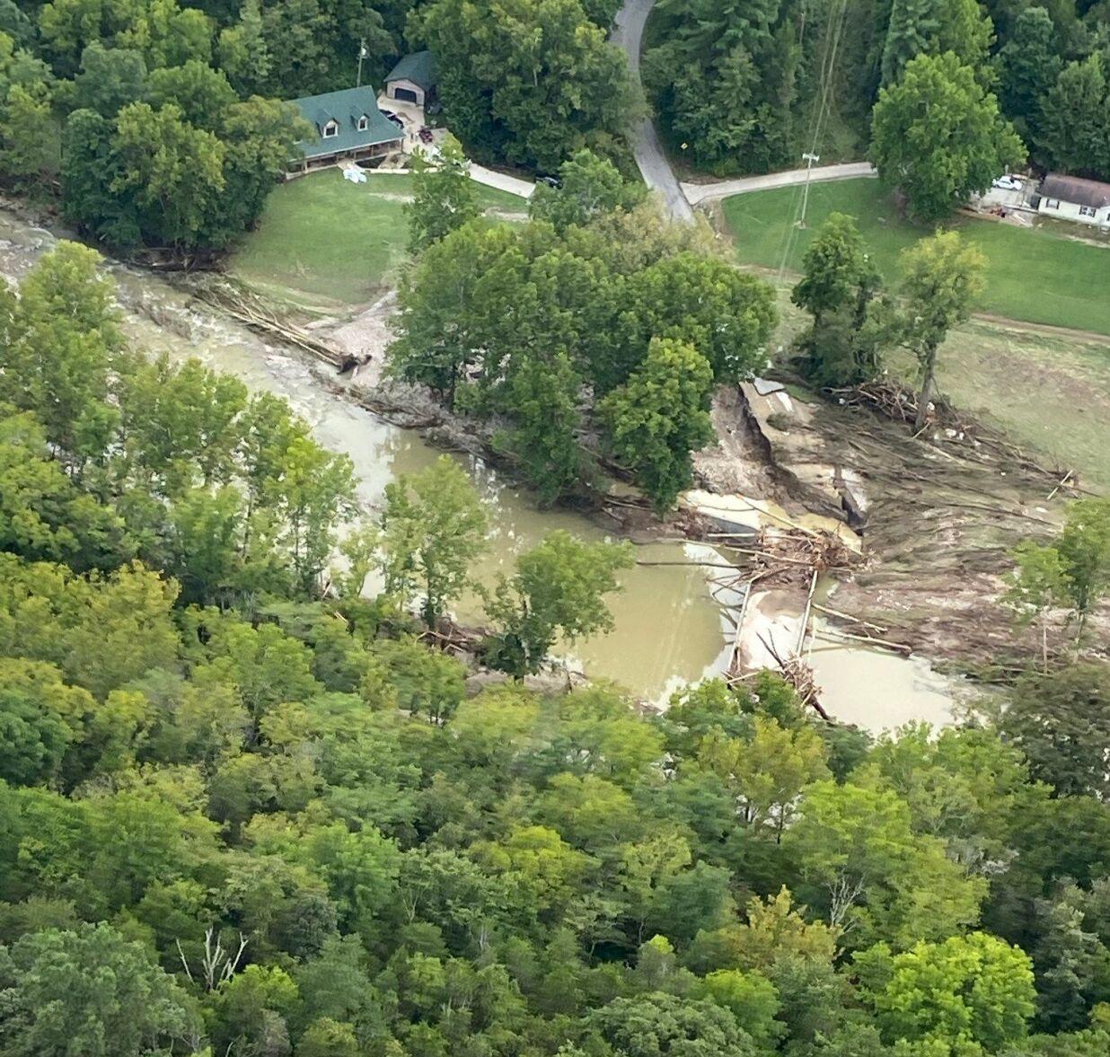
This was near Manville, Indiana, where other houses were also washed away.

The National Weather Service still has our eastern communities under a Flood Watch through midnight because of the risk of heavy rain leading to flash flooding or larger-scale river and stream flooding.

The National Weather Service has issued a Flash Flood Watch for the southern part of our area until 7 PM Central time tonight. Heavy rain is already causing flash flooding in some of these communities and more rain and storms could make the problem worse throughout the day.
Last night a thunderstorm parked itself over downtown Louisville and dropped a lot of rain which led to flash flooding. We experienced some of that here at WDRB, but Thursday's flash flooding pales in comparison to what we've seen here before.

A Flash Flood Watch has been issued for part of our area Saturday night through Sunday morning. The Watch is valid through 8 AM Sunday as another round of strong storms with heavy rain will move through overnight.

A Flash Flood Watch has been issued for many of our WDRB communities Thursday until 8 PM. While rain is possible all across our area, these highlighted areas are most at risk for seeing flash flooding today.

Top Story
The city needs those impacted to complete damage assessment forms.

Severe weather warnings are changing, and you have already seen some of these this season!

A Flash Flood Watch has been issued for a large part of our area Wednesday night through Thursday morning. The Watch goes into effect Wednesday at 11 PM as heavy rain is likely overnight.