This weeks marks the 13th anniversary of the January snow and ice storm across Kentucky. Do you remember where you were and what you were doing through January 26-28, 2009?
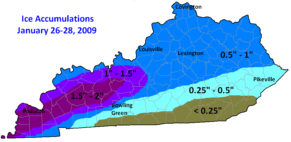
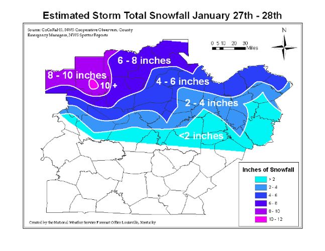
The map above shows estimated ice accumulation across the Commonwealth based on observations compiled the the National Weather Service. The map below shows snow totals in our area from this same event.

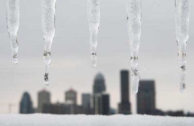
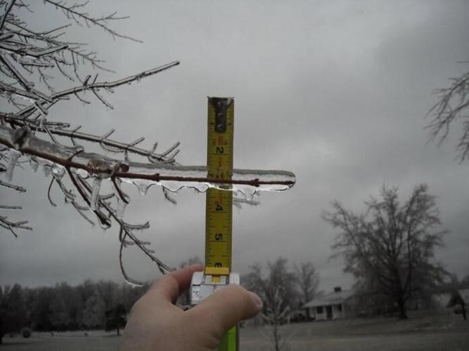
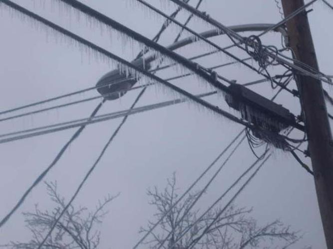
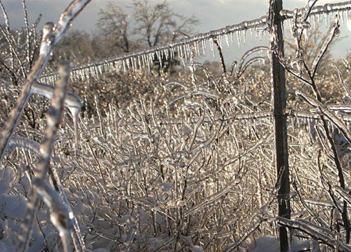
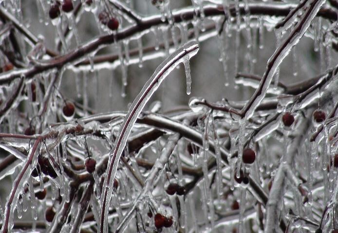
The discussion below comes from the National Weather Service office in Louisville, and they also shared the images in the slideshow below. The text description with each picture tells you where it was taken and who took the picture (if known).
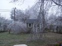
2009 January Ice and Snow Pictures
Bowling Green David Tooley
Buffalo in Larue County
Clarkson, KY Scotty Gore
Crawford County, Wade Bell

Tim Kiger, Leitchfield
Bill Atchley, Munfordville, KY
Mike Curran, Palmyra
Radcliff, KY, Anita Conder
Ken Smith, Windyville, KY
Tom at National Weather Service in Louisville
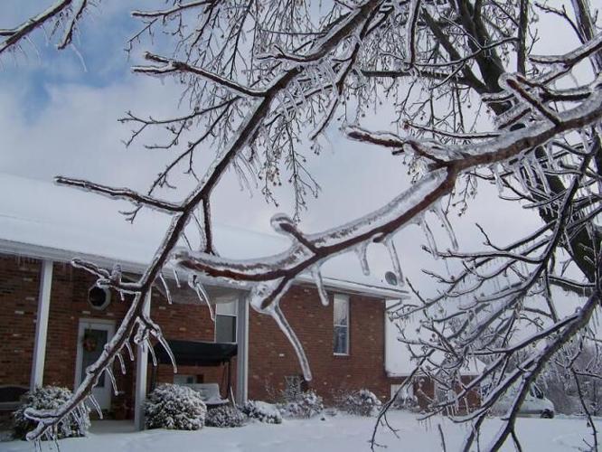
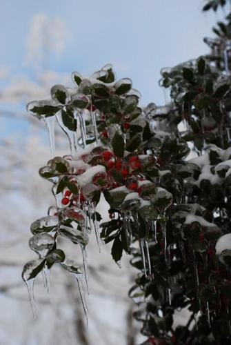
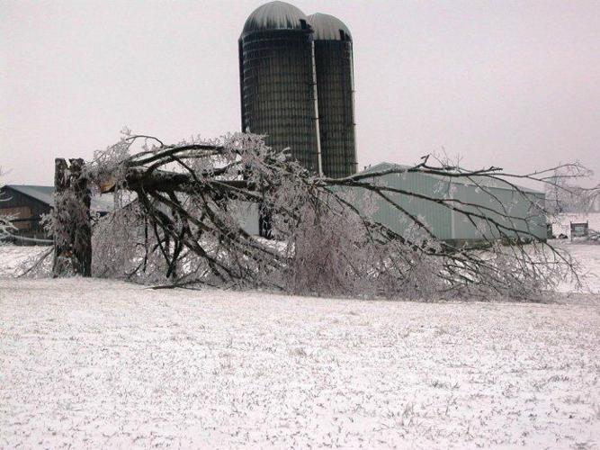
"A wintry mix moved into southern Indiana and central Kentucky on the night of Monday, January 26, 2009. Precipitation began as light freezing drizzle and freezing rain over the entire area, but changed to sleet and then snow overnight into the early morning hours of Tuesday across southern Indiana and northern Kentucky. Up to 6 inches of snow accumulated across the northernmost sections of the CWA. Freezing rain continued over southern Kentucky. On Tuesday the 27th, precipitation changed to freezing rain over southern Indiana and northern Kentucky, and to rain over southern Kentucky. Ice over an inch thick was reported in many locations from the freezing rain. Tuesday night freezing rain and sleet continued over southern Indiana, freezing rain transitioned to rain over northern Kentucky, and rain, occasionally heavy, continued over southern Kentucky. Minor...mainly river flooding developed in some spots by Wednesday from the steady rain. On the morning of Wednesday, January 28, precipitation changed over to snow from northwest to southeast across the area. About 3 to 4 inches of additional snow accumulation piled up in the north, with less to the south.
The storm caused Kentucky's largest power outage on record, with 609,000 homes and businesses without power across the state. Property damage was widespread, with the damage due to falling trees, large tree limbs, and power lines weighed down by ice. In the Louisville metropolitan area 205,000 lost power and it took up to 10 days to get everyone hooked back up. Area school systems were closed for an entire week. Several emergency shelters were set up across the affected region. In Louisville's local school system, 69 schools lost power."


